place

Spring Run (West Branch Susquehanna River tributary)

Rivers of Northumberland County, PennsylvaniaRivers of PennsylvaniaTributaries of the West Branch Susquehanna River
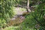
Spring Run looking upstream

Spring Run (also known as The Gut) is a tributary of the West Branch Susquehanna River in Northumberland County, Pennsylvania, in the United States. It is approximately 2.3 miles (3.7 km) long and flows through Delaware Township and Watsontown. The watershed of the stream has an area of 1.34 square miles (3.5 km2). The stream is designated as an impaired waterbody due to sedimentation/siltation and unknown causes. The stream is classified as a Warmwater Fishery.

Excerpt from the Wikipedia article Spring Run (West Branch Susquehanna River tributary) (License: CC BY-SA 3.0, Authors, Images).

Spring Run (West Branch Susquehanna River tributary)
Canal Towpath Trail,

Geographical coordinates (GPS) Address Nearby Places
placeShow on map

Wikipedia: Spring Run (West Branch Susquehanna River tributary)Continue reading on Wikipedia

Geographical coordinates (GPS)

Latitude Longitude
N 41.0883 ° E -76.87449 °
placeShow on map

Address

Canal Towpath Trail

Canal Towpath Trail
17777
Pennsylvania, United States
mapOpen on Google Maps

Spring Run looking upstream
Share experience

Nearby Places

White Deer Creek
White Deer Creek

White Deer Creek is a tributary of the West Branch Susquehanna River in Centre County and Union County, in Pennsylvania, in the United States. It is approximately 28 miles (45 km) long and flows through Miles Township in Centre County and Hartley Township, Lewis Township, West Buffalo Township, and White Deer Township in Union County. The watershed of the creek has an area of 45.1 square miles (117 km2). Parts of the creek are designated as impaired. The creek's discharge near White Deer can be as low as 3 cubic feet per second (0.085 m3/s) or as high as 169 cubic feet per second (4.8 m3/s). White Deer Creek is a freestone stream in mountainous terrain. It is relatively small and flows through a valley that is narrow, but can be up to 1,000 feet (300 m) wide. The creek flows alongside Interstate 80 for much of its length. A significant part of the land in the creek's watershed is forested, with large areas being owned by the Pennsylvania Bureau of Forestry. The watershed of the creek is designated as a High-Quality Coldwater Fishery and a Migratory Fishery. It has both brook trout and brown trout and is stocked with trout. White Deer Creek's name comes from the word Woap'-achtu-hanne, meaning "white-deer stream". The creek appeared on maps as early as 1759. A number of mills were erected adjacent to it during the eighteenth and nineteenth centuries. Major historic industries in the watershed included lumbering and agriculture. A number of bridges have been erected across the creek. Much of the length of White Deer Creek is in Bald Eagle State Forest; the creek also passes through McCalls Dam State Park. Other recreational opportunities include angling and canoeing.