place

York, Toronto

1998 disestablishments in OntarioAC with 0 elementsBlack Canadian culture in TorontoBlack Canadian settlementsFormer cities in Ontario
Former municipalities in TorontoMetropolitan TorontoNeighbourhoods in TorontoPopulated places disestablished in 1998
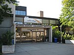
Intersection of Oakwood and Eglinton, 2013 04 09 ak (15503918995)

York is a former city within the current city of Toronto, Ontario, Canada. It is located northwest of Old Toronto, southwest of North York and east of Etobicoke, where it is bounded by the Humber River. The city has a population of 145,662 as of 2016. As a separate city, it was one of six municipalities that amalgamated in 1998 to form the current city of Toronto. The City of York was created by the amalgamation of several villages, including the present-day neighbourhoods of Lambton Mills and Weston. The city has a diversified character and is home to a number of Italian, Portuguese and Jamaican neighborhoods.

Excerpt from the Wikipedia article York, Toronto (License: CC BY-SA 3.0, Authors, Images).

York, Toronto
Eglinton Avenue West, Toronto York

Geographical coordinates (GPS) Address Nearby Places
placeShow on map

Wikipedia: York, TorontoContinue reading on Wikipedia

Geographical coordinates (GPS)

Latitude Longitude
N 43.689829 ° E -79.478066 °
placeShow on map

Address

York Civic Centre

Eglinton Avenue West 2700
M6M 1T9 Toronto, York
Ontario, Canada
mapOpen on Google Maps

Intersection of Oakwood and Eglinton, 2013 04 09 ak (15503918995)
Share experience

Nearby Places

Keelesdale station
Keelesdale station

Keelesdale is an underground light rail transit (LRT) station under construction on Line 5 Eglinton, a new line that will be part of the Toronto subway system. It will be located in the Silverthorn neighbourhood at the intersection of Keele Street and Eglinton Avenue and is scheduled to open in 2022. Nearby destinations include the York Civic Centre, Keelesdale Park and Chris Tonks Arena, York Memorial Collegiate Institute, George Harvey Collegiate Institute, the Humber River Regional Hospital's Keele campus, and the Silverthorn neighbourhood. The primary entrance and an off-street bus loop are located at the northeast corner of Eglinton Avenue and Trethewey Drive. A secondary entrance is located on the northwest corner of Eglinton Avenue and Trethewey Drive adjacent to York Memorial Collegiate. A third entrance is located at the southeast corner of Eglinton Avenue and Keele Street. The primary entrance will be fully accessible and have a station plaza with a landscaped public space. The station will have four bus bays plus on-street connections for TTC buses. Noise attenuation walls will be placed between the bus bays and neighbouring houses. There will be outdoor parking for 60 bicycles.During the planning stages for Line 5 Eglinton, the station was given the working name "Keele", which is identical to the pre-existing Keele station on Line 2 Bloor–Danforth. On November 23, 2015, a report to the TTC Board recommended giving a unique name to each station in the subway system (including Line 5 Eglinton). Thus, the LRT station was renamed "Keelesdale". Silverthorn was also considered.Before construction, land expropriations and demolitions were required. The primary entrance is at the site of former EMS Station 19 and a car wash. The secondary entrance is at the site of a former Coffee Time outlet and its adjacent parking lot.

Kodak Heights
Kodak Heights

Kodak Mount Dennis Campus, also known as Kodak Heights, was an industrial park in the Mount Dennis neighbourhood of Toronto, Ontario, Canada. It was owned and operated by the Eastman Kodak Company as a major camera manufacturing factory since its opening in 1912, peaking at 900 employees in 1925, 3,000 in the 1970s, falling to about 800 before it ceased the plant's operations in 2006.Kodak had opened its Canadian operations on November 8, 1899, first on Colborne Street and then King Street in the downtown core. By 1912 the company was growing so rapidly that a new corporate campus was needed. George Eastman personally visited Toronto to view potential sites, eventually selecting the Mount Dennis area, which at that time was farmland. In 1913 the company purchased 10 hectares (25 acres) at $12,000 per hectare ($5,000/acre) and began construction as soon as the deed was transferred. A series of seven buildings were initially constructed, including two that were connected by an enclosed bridge. The first to be completed, Building 1, was the power plant, which connected to the Canadian Pacific Railway just south of the plant with a spur that ended inside the building. It burned about 500 tonnes of coal a day. The move from the King Street facilities began in 1916, completed the next year.The 19-hectare (48-acre) campus once contained over a dozen buildings, of which only Kodak Building 9 remains standing. The building was abandoned until 2013 when the land was acquired by Metrolinx to construct the Eglinton Crosstown line. It will be the location of the Mount Dennis LRT station main entrance with a bus terminal, and the Eglinton Maintenance and Storage Facility nearby. Corporate offices moved to 200 Monogram Place in Etobicoke.