place

Marshside, Kent

City of CanterburyHamlets in KentKent geography stubs
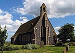
Home Farm, Marshside

Marshside is a hamlet in the county of Kent, England. It is in the parish of Chislet alongside the Chislet Marshes southeast of Herne Bay.

Excerpt from the Wikipedia article Marshside, Kent (License: CC BY-SA 3.0, Authors, Images).

Marshside, Kent
North Stream, Canterbury

Geographical coordinates (GPS) Address Nearby Places
placeShow on map

Wikipedia: Marshside, KentContinue reading on Wikipedia

Geographical coordinates (GPS)

Latitude Longitude
N 51.3508 ° E 1.1931 °
placeShow on map

Address

North Stream

North Stream
CT3 4EQ Canterbury
England, United Kingdom
mapOpen on Google Maps

Home Farm, Marshside
Share experience

Nearby Places

Upstreet
Upstreet

Upstreet is a village in the civil parish of Chislet in Kent, England. It is in the local government district of Canterbury, and the electoral ward of Marshside. It is about 62 miles away from London.Upstreet is a ribbon development along the A28 road. The majority of houses are new and dating from the 1950s onwards. However, there are a number of older houses such as the Grade II listed building 'Grove Court' or the Grade I listed 'Upstreet Farmhouse', which was built in the 16th century and stands in an acre of its own land. It had notable different purposes over the years and is known to be haunted. Also listed are 'Hamilton's' and 'The Vision House' (No89 and No94)Upstreet was mentioned in the 1830s Swing Riots, when a widespread uprising by agricultural workers in southern and eastern England occurred, in protest at agricultural mechanisation and harsh working conditions. Several fires were carried at different farms as part of the protests.Close to Upstreet is the Stodmarsh National Nature Reserve, Grove Ferry Picnic Area and the River Stour. Also the Saxon Shore Way (long-distance footpath) also passes the village between Chislet and Stourmouth. Upstreet has a few services (a shop, two elderly care homes, one pub and one car sales lot), the garage having closed through 2015. The number of services is declining due to rising car ownership. For example, 45 years ago there was a railway station, haberdashery, greengrocer's, butcher's, baker's etc. However now there is no railway station and the shop consolidates the uses of a post office, greengrocer's, haberdashery, baker's, butcher's, etc. all under one roof. The pub is worked at by many of the locals, including a few teenagers from the village, most notably waitress Moon, and is owned by another of the locals. There is a karaoke machine and jukebox, and a quiz night on Thursdays at 8pm. The pub is a main place where locals from Sturry to Minster can all socialise, and catch up. The pub remains open through COVID-19 restrictions. One of the house's was also featured on Homes Under the Hammer https://www.bbc.co.uk/programmes/b08h56j3

Reculver
Reculver

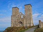
Reculver is a village and coastal resort about 3 miles (5 km) east of Herne Bay on the north coast of Kent in south-east England. It is in the ward of the same name, in the City of Canterbury district of Kent. Reculver once occupied a strategic location at the north-western end of the Wantsum Channel, a sea lane that separated the Isle of Thanet and the Kent mainland until the late Middle Ages. This led the Romans to build a small fort there at the time of their conquest of Britain in 43 AD, and, starting late in the 2nd century, they built a larger fort, or castrum, called Regulbium, which later became one of the chain of Saxon Shore forts. Following the withdrawal of the Western Roman Empire in ca. early C4th, the Brythons again took control of the lands until Anglo-Saxon invasions shortly afterward. By the 7th century Reculver had become a landed estate of the Anglo-Saxon kings of Kent. The site of the Roman fort was given over for the establishment of a monastery dedicated to St Mary in 669 AD, and King Eadberht II of Kent was buried there in the 760s. During the Middle Ages Reculver was a thriving township with a weekly market and a yearly fair, and it was a member of the Cinque Port of Sandwich. The settlement declined as the Wantsum Channel silted up, and coastal erosion claimed many buildings constructed on the soft sandy cliffs. The village was largely abandoned in the late 18th century, and most of the church was demolished in the early 19th century. Protecting the ruins and the rest of Reculver from erosion is an ongoing challenge. The 20th century saw a revival as local tourism developed and there are now two caravan parks. The census of 2001 recorded 135 people in the Reculver area, nearly a quarter of whom were in caravans at the time. The Reculver coastline is within a Site of Special Scientific Interest, a Special Protection Area and a Ramsar site, including most of Reculver Country Park, which itself includes much of Bishopstone Cliffs local nature reserve. While nationally scarce plants and insects are found there, the location is also important for migrating birds and is of significant geological interest.