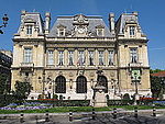
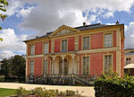
Avenue Charles-de-Gaulle (Neuilly-sur-Seine)

Avenue Charles-de-Gaulle is an avenue in Neuilly-sur-Seine, Paris, France, named after Charles de Gaulle. The avenue forms part of the Route nationale 13. Until 1971, it was called Avenue de Neuilly, a rare case in France where the road bears the name of the commune in which it is found. Avenue Charles-de-Gaulle continues along Paris's axe historique, which stretches from the original Palais des Tuileries to Porte Maillot, and which finishes at Pont de Neuilly. It forms a segment of the axe majeur, which links Paris and La Défense. It is used by a daily flow of 160,000 vehicles.Since 1992, part of the avenue passed underground for 440 metres (1,440 ft), at the exit of Neuilly-sur-Seine. This was due to the completion of the couverture Madrid.
Excerpt from the Wikipedia article Avenue Charles-de-Gaulle (Neuilly-sur-Seine) (License: CC BY-SA 3.0, Authors, Images).Avenue Charles-de-Gaulle (Neuilly-sur-Seine)
Avenue Charles de Gaulle, Arrondissement of Nanterre
Geographical coordinates (GPS) Address Nearby Places Show on map
Geographical coordinates (GPS)
| Latitude | Longitude |
|---|---|
| N 48.8831 ° | E 2.2656 ° |
Address
Avenue Charles de Gaulle
Avenue Charles de Gaulle
92200 Arrondissement of Nanterre
Ile-de-France, France
Open on Google Maps


