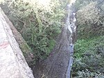
Pant, Shropshire

Pant is a village in Shropshire, England. It lies near the border with Wales. Pant means 'hollow' in Welsh: it is located directly below the disused mines at Llanymynech Rocks Nature Reserve. The population at the 2011 census is listed under the Civil Parish of Llanymynech and Pant. The built-up area of Pant and Llanymynech is roughly 2,000. Pant has a few notable features: Llanymynech Golf Club is unique as the only 18 hole course in the UK to straddle the border between two countries; Llanymynech Ogof, a copper mine where many Roman artefacts have been found; Bryn Offa Church of England Primary School, a school built after the closure of four schools in the surrounding area; and a large gin wheel in the village. This quiet village was once much more lively, with several shops and a post office.
Excerpt from the Wikipedia article Pant, Shropshire (License: CC BY-SA 3.0, Authors, Images).Pant, Shropshire
Brooklyn Road,
Geographical coordinates (GPS) Address Nearby Places Show on map
Geographical coordinates (GPS)
| Latitude | Longitude |
|---|---|
| N 52.794 ° | E -3.075 ° |
Address
Brooklyn Road
Brooklyn Road
SY10 9RE , Llanymynech and Pant
England, United Kingdom
Open on Google Maps


