Mahlberg (mountain)
Karlsruhe (district)Mountains and hills of Baden-WürttembergMountains and hills of the Black ForestMountains under 1000 metresRastatt (district)

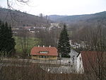
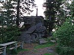
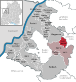
The Mahlberg is a mountain in the northwest of the Northern Black Forest and, at 612.5 m above sea level (NHN), is the highest point in the Baden-Württemberg county of Karlsruhe and the parish of Völkersbach. Its eastern side belongs to the municipality of Malsch in Karlsruhe and the western side to the borough of Gaggenau in the county of Rastatt.
Excerpt from the Wikipedia article Mahlberg (mountain) (License: CC BY-SA 3.0, Authors, Images).Mahlberg (mountain)
Oberer Mahlbergweg,
Geographical coordinates (GPS) Address Nearby Places Show on map
Geographical coordinates (GPS)
| Latitude | Longitude |
|---|---|
| N 48.8357083 ° | E 8.377 ° |
Address
Oberer Mahlbergweg
76571
Baden-Württemberg, Germany
Open on Google Maps


