The Hanoverian Moor Geest (German: Hannoversche Moorgeest) is a gently rolling landscape between Hanover and Nienburg in the German state of Lower Saxony covering an area of around 800 square kilometres (310 sq mi). It belongs to the raised bog regions of northwest Germany, which cover the geest terrain formed during the ice age and which stretch from the Netherlands to the eastern border of Lower Saxony. The geest tract on the Hanoverian Moor Geest consists of a ground moraine plateau with a height of 50–85 metres (164–279 ft) above sea level that is dominated by bog. Its natural boundaries are the Aller glacial valley to the north and the Burgdorf-Peine Geest to the east.
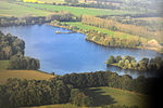
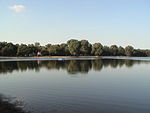
This geest terrain, with its small villages, has a distinctly rural character. The exception is the town of Neustadt am Rübenberge. Within the region's borders lies the Steinhuder Meer, a lake 30 square kilometres (12 sq mi) in area, in a shallow basin. Originally this inland water was three times the size as can be seen from its boggy fringes to the west and southwest.
Much of the rest of the area used to consist of raised bogs. These were, however, frequently harvested for peat and cultivated for agricultural purposes. Most of the bogs that have been preserved have been much reduced in size, such as the Altwarmbüchen Moor, the Bissendorf Moor, the Helstorf Moor, the Schwarzes Moor, the Totes Moor and the Otternhagen Moor. Peat-cutting has resulted in artificial arable fields that have a boggy character. This makes their agricultural use quite limited. The forests consist mainly of pine trees used by the forestry industry. Deciduous woods occur occasionally on the end moraines. The depressions are extensively used by farmers for grassland. Whilst most of the bogs are under conservation protection today, the Totes Moor near Neustadt will still be used to harvest industrial peat on a large scale until about 2019.
The region of Hanover is running the Hannoverian Moor Geest Nature Conservation Project from 2006-2016 which aims to permanently protect the four bogs in the Moor Geest region.


