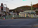
Visitacion Valley, San Francisco

Visitacion Valley (VIZ-i-TAY-shən; Spanish: Valle de la Visitación), colloquially referred to as Viz Valley, is a neighborhood located in the southeastern quadrant of San Francisco, California. Visitacion Valley is roughly defined by McLaren Park and Gleneagles Golf Course to the West, Mansell Blvd and Portola to the north, Bayview Hill and Candlestick Cove to the east, and the San Francisco / San Mateo County line to the south. The streets of this neighborhood straddle the border between San Francisco and Daly City, hence partially blending with the adjacent Daly City neighborhood of Bayshore. The grounds of the Cow Palace, straddling the San Francisco/Daly City border, are partially within Visitacion Valley.
Excerpt from the Wikipedia article Visitacion Valley, San Francisco (License: CC BY-SA 3.0, Authors, Images).Visitacion Valley, San Francisco
San Bruno Avenue, San Francisco
Geographical coordinates (GPS) Address Nearby Places Show on map
Geographical coordinates (GPS)
| Latitude | Longitude |
|---|---|
| N 37.716666666667 ° | E -122.4 ° |
Address
San Bruno Avenue 3574;3576;3578;3580;3582;3584;3586;3588;3590
94134 San Francisco
California, United States
Open on Google Maps


