Clarks Point (San Francisco)
Landforms of San Francisco

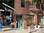
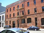
Clarks Point was a cape on the north side of Yerba Buena Cove in what is now San Francisco, California. Its former Spanish name was Punta Del Embarcadera. During the California Gold Rush the Clarks Point and the Cove was filled in to form the Embarcadero on San Francisco Bay. The location of the Point is just east of the intersection of Battery Street on Broadway.
Excerpt from the Wikipedia article Clarks Point (San Francisco) (License: CC BY-SA 3.0, Authors, Images).Clarks Point (San Francisco)
Broadway, San Francisco
Geographical coordinates (GPS) Address Nearby Places Show on map
Geographical coordinates (GPS)
| Latitude | Longitude |
|---|---|
| N 37.798611111111 ° | E -122.40111111111 ° |
Address
Broadway 255
94111 San Francisco
California, United States
Open on Google Maps


