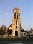
Créteil
Cities in Île-de-FranceCommunes of Val-de-MarneCréteilPrefectures in France

Créteil (French pronunciation: [kʁetɛj] (listen)) is a commune in the southeastern suburbs of Paris, Île-de-France. It is located 11.5 km (7.1 mi) from the centre of Paris. Créteil is the préfecture (capital) of the Val-de-Marne department as well as the seat of the Arrondissement of Créteil. The city is, moreover, the seat of a Roman Catholic diocese and of one of France's 30 nationwide académies (districts) of the Ministry of National Education.
Excerpt from the Wikipedia article Créteil (License: CC BY-SA 3.0, Authors, Images).Créteil
Avenue Pierre Brossolette, Créteil
Geographical coordinates (GPS) Address Nearby Places Show on map
Geographical coordinates (GPS)
| Latitude | Longitude |
|---|---|
| N 48.7911 ° | E 2.4628 ° |
Address
Avenue Pierre Brossolette 45
94000 Créteil, Centre Ancien - Chenevier - Déménitroux
Ile-de-France, France
Open on Google Maps


