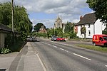
Winterbourne, Wiltshire

Winterbourne is a civil parish in south east Wiltshire, England, about 3.5 miles (6 km) northeast of Salisbury. The parish encompasses the contiguous villages of Winterbourne Dauntsey, Winterbourne Earls and Winterbourne Gunner, together with the hamlet of Hurdcott south of Winterbourne Earls (not to be confused with Hurdcott Manor near Baverstock). The Port Way Roman road passes the villages on higher ground, on its route towards Old Sarum. The settlements are in the Bourne valley which also carries the A338 road and the West of England Main Line railway. Winterbourne was an earlier name for the river, which becomes dry in summer. The parish has one Grade I listed building: the 12th-century St Mary's church at Winterbourne Gunner.
Excerpt from the Wikipedia article Winterbourne, Wiltshire (License: CC BY-SA 3.0, Authors, Images).Winterbourne, Wiltshire
Great Drove,
Geographical coordinates (GPS) Address Nearby Places Show on map
Geographical coordinates (GPS)
| Latitude | Longitude |
|---|---|
| N 51.11 ° | E -1.76 ° |
Address
Great Drove
Great Drove
SP4 6HR , Winterbourne
England, United Kingdom
Open on Google Maps


