place

Queenston

Neighbourhoods in Niagara-on-the-LakePopulated places established in the 1770sQuarries in CanadaSurface mines in Canada
Historic village of Queenstown and Lower Niagara River, from Queenston Heights, Canada (HS85 10 39012)

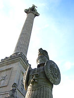
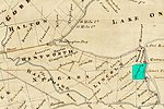
Queenston is a compact rural community and unincorporated place 5 kilometres (3.1 mi) north of Niagara Falls in the Town of Niagara-on-the-Lake, Ontario, Canada. It is bordered by Highway 405 to the south and the Niagara River to the east; its location at the eponymous Queenston Heights on the Niagara Escarpment led to the establishment of the Queenston Quarry in the area. Across the river and the Canada–US border is the village of Lewiston, New York. The Lewiston-Queenston Bridge links the two communities. This village is at the point where the Niagara River began eroding the Niagara Escarpment. During the ensuing 12,000 years the Falls cut an 11 kilometres (6.8 mi) long gorge in the Escarpment southward to its present-day position.In the early 19th century, the community's name was spelled as Queenstown.Queenston marks the southern terminus of the Bruce Trail. The cairn marking the trail's terminus is in a parking lot, about 160 metres (520 ft) from General Brock's Monument on the easterly side of the monument's park grounds.

Excerpt from the Wikipedia article Queenston (License: CC BY-SA 3.0, Authors, Images).

Queenston
Dumfries Street,

Geographical coordinates (GPS) Address Nearby Places
placeShow on map

Wikipedia: QueenstonContinue reading on Wikipedia

Geographical coordinates (GPS)

Latitude Longitude
N 43.165 ° E -79.055833333333 °
placeShow on map

Address

Dumfries Street 18
L0S 1L0
Ontario, Canada
mapOpen on Google Maps

Historic village of Queenstown and Lower Niagara River, from Queenston Heights, Canada (HS85 10 39012)
Share experience

Nearby Places

Stamford Township
Stamford Township

Stamford Township is a former incorporated and now geographic township in Upper Canada, later Ontario, on the Niagara Peninsula. It was originally designated Township #2 in the Home District of the Quebec Colony in Canada. Following the creation of Upper Canada in 1791, Township #2 was renamed Stamford and placed within the newly created County of Lincoln. When Lincoln county was divided into Lincoln (north) and Welland (south) counties in 1851, Township #2 was placed in Welland County. The first survey took place around 1776, during the American Revolutionary War. Twelve European-American families came to settle in the area, including the Cooks and Durhams from New Jersey. It was developed and settled initially by Loyalists, primarily from New York State and other areas of the British colonies with the first two settlers being the Thomas McMicking and Philip Bender families. and later the Thompson and Bastedo families, among numerous others. The British Crown granted land to Loyalists in Upper Canada to compensate them for their losses in the Revolution and to settle this area. As the second township in the region surveyed, it was named Township #2, and sometimes referred to as Mount Dorchester for Sir Guy Carleton Lord Dorchester. Another survey was conducted in 1787, following the United States achieving independence. The area was named Stamford in 1787 by John Graves Simcoe, the first Lieutenant Governor of Upper Canada, as the largest area in the township was already known as Stamford Village, It was given royal status in 1791. New settlers were initially mostly ethnic British, although some from New York also had more distant Dutch, Mohawk and French ancestry. The first municipal government was established in 1793. Its first two Wardens were John Wilson and Thomas McMicking.Stamford Village was the largest community in the township, dating back to 1783. Although as a village it had no formal municipal government or status, it was referred to as Stamford, apparently after Stamford Village in Delaware County in New York where some pioneers originally settled. The building of the Stamford Meeting House took place in 1787 next to the local cemetery which villagers called God's Half Acre. This Meeting House became the Stamford Presbyterian Church, the first Presbyterian Church in Upper Canada (circa 1844). In 1962 the township was amalgamated with the city of Niagara Falls, Ontario.

Lewiston–Queenston Bridge

The Lewiston–Queenston Bridge, also known as the Queenston–Lewiston Bridge, is an arch bridge that crosses the Niagara River gorge just south of the Niagara Escarpment. The bridge was officially opened on November 1, 1962. It is an international bridge between the United States and Canada. It connects Interstate 190 in the town of Lewiston, New York to Highway 405 in the community of Queenston, Ontario. The Lewiston–Queenston Bridge is architecturally similar to the Rainbow Bridge at nearby Niagara Falls. Customs plazas are located on both ends of the bridge, with tolls only being charged on entering Canada ($5.00 USD or $6.50 CAD per passenger automobile). The bridge accepts E-ZPass electronic toll collection and houses the second Canadian E-ZPass collection facility, after the nearby Peace Bridge. Also, two duty-free stores are located between the two plazas. The bridge permits no pedestrians, but licensed taxi service is permitted. The Lewiston–Queenston Bridge lacks expedited border clearance facilities for NEXUS and FAST card holders traveling from the United States into Canada, but does have a NEXUS lane for travel into the United States. Gantries have lights indicating the direction of traffic as the lanes are reversible. Speed limit is posted in kilometres and miles per hour (15 mph or 24 km/h limit) along the bridge. Canadian and United States flags fly at the midpoint on the south side of the bridge.