place

Vrooman's Point

Geography of the Regional Municipality of NiagaraGolden Horseshoe geography stubsTourist attractions in the Regional Municipality of Niagara
Vrooman's
Vrooman's

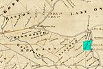
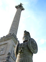
Vrooman's Point is a geographical feature in Ontario, Canada, near the border with the United States. The point projects out into the course of the Niagara River, and is located about a mile north of the town of Queenston, Ontario. The point is also near the city of Lewiston, New York across the river. It was either named after Sergeant Adam Vrooman of the Loyalist Regiment, Butler's Rangers, who originally acquired the property, or after his eldest son, Solomon, who inherited it in 1810 and lived there in 1812. During the Battle of Queenston Heights in the War of 1812, Vrooman's Point was the location of a vital British twenty-four-pounder artillery piece. Despite being near the limits of its range trying to bombard the battle, the piece harassed American troops on the American shore trying to embark their boats for Canada and the battle, as well as providing support for the British recapture of the heights. The cannon was commanded by Captain Samuel Hatt of the Upper Canadian militia and Lieutenant John Ball.A monument commemorating the point's role in the battle has been erected. Together with the other monuments to the battle in the area, the point is a popular tourist site.

Excerpt from the Wikipedia article Vrooman's Point (License: CC BY-SA 3.0, Authors, Images).

Vrooman's Point
Service Road 53,

Geographical coordinates (GPS) Address Nearby Places
placeShow on map

Wikipedia: Vrooman's PointContinue reading on Wikipedia

Geographical coordinates (GPS)

Latitude Longitude
N 43.177517 ° E -79.056888 °
placeShow on map

Address

Service Road 53

Service Road 53
L0S 1L0
Ontario, Canada
mapOpen on Google Maps

Vrooman's
Vrooman's
Share experience

Nearby Places

Stamford Township
Stamford Township

Stamford Township is a former incorporated and now geographic township in Upper Canada, later Ontario, on the Niagara Peninsula. It was originally designated Township #2 in the Home District of the Quebec Colony in Canada. Following the creation of Upper Canada in 1791, Township #2 was renamed Stamford and placed within the newly created County of Lincoln. When Lincoln county was divided into Lincoln (north) and Welland (south) counties in 1851, Township #2 was placed in Welland County. The first survey took place around 1776, during the American Revolutionary War. Twelve European-American families came to settle in the area, including the Cooks and Durhams from New Jersey. It was developed and settled initially by Loyalists, primarily from New York State and other areas of the British colonies with the first two settlers being the Thomas McMicking and Philip Bender families. and later the Thompson and Bastedo families, among numerous others. The British Crown granted land to Loyalists in Upper Canada to compensate them for their losses in the Revolution and to settle this area. As the second township in the region surveyed, it was named Township #2, and sometimes referred to as Mount Dorchester for Sir Guy Carleton Lord Dorchester. Another survey was conducted in 1787, following the United States achieving independence. The area was named Stamford in 1787 by John Graves Simcoe, the first Lieutenant Governor of Upper Canada, as the largest area in the township was already known as Stamford Village, It was given royal status in 1791. New settlers were initially mostly ethnic British, although some from New York also had more distant Dutch, Mohawk and French ancestry. The first municipal government was established in 1793. Its first two Wardens were John Wilson and Thomas McMicking.Stamford Village was the largest community in the township, dating back to 1783. Although as a village it had no formal municipal government or status, it was referred to as Stamford, apparently after Stamford Village in Delaware County in New York where some pioneers originally settled. The building of the Stamford Meeting House took place in 1787 next to the local cemetery which villagers called God's Half Acre. This Meeting House became the Stamford Presbyterian Church, the first Presbyterian Church in Upper Canada (circa 1844). In 1962 the township was amalgamated with the city of Niagara Falls, Ontario.

Lewiston (village), New York

Lewiston is a village in Niagara County, New York, United States. The population was 2,701 at the 2010 census. The village is named after Morgan Lewis, an early 19th-century governor of New York. It is part of the Buffalo–Niagara Falls Metropolitan Statistical Area. The Village of Lewiston, NY (also known as Yehęwakwáʼthaʼ in Tuscarora) is within the Town of Lewiston. The Earl W. Brydges Artpark State Park lies at its southern border. Lewiston was selected by Rand McNally as one of the "Top Ten Best Small Towns in America" in November 2012. Lewiston is situated on the Niagara River, just across the river from Canada. The Niagara River intersects the Niagara Escarpment between Lewiston and Queenston, Ontario, identifying the escarpment's Lewiston-Queenston section as the geologic origin of Niagara Falls. Over a roughly 12,500 year span, the falls have eroded nearly seven miles south from Lewiston to their present location in Niagara Falls, creating the seven-mile long Niagara Gorge. Lewiston lies halfway between the world-famous Niagara Falls and historic Fort Niagara in Youngstown. Niagara Falls is approximately a ten-minute drive to the south. Visitors from Canada can take the Lewiston-Queenston Bridge across the Niagara River. Popular summer festivals include the Outdoor Art Festival (the second weekend in August) and the Historic Lewiston Jazz Festival (the last weekend in August). The famous Kiwanis Peach Festival takes place during the second weekend of September. Several other festivals, such as the Harvest Fest, take place during the year. Most are held on or near Center Street, the Village's main street (18F North). Lewiston recently won an online voting contest sponsored by USA Today and Rand McNally for "Best for Food" small town in America, beating 176 other communities. Lewiston has over 30 locally owned and operated restaurant/food establishments within a mile, primarily on Center Street, catering to a variety of tastes. It was also designated in the same contest as one of the "Top Ten Best Small Towns in America."