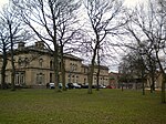
Almondbury

Almondbury is a village 2 miles (3.2 km) south-east of Huddersfield town centre in West Yorkshire, England. The population of Almondbury in 2001 was 7,368 increasing to 18,346 at the 2011 Census.Almondbury appears in the Domesday Book as "Almondeberie". After the Norman Conquest, the land around the village was held by the powerful De Lacy family, who gave their name to De Lacy Avenue. For 300 years until the 17th century, the village's Monday Market was the most important in the area. Almondbury was the hub of parish activity and in its early history was a more important centre than the town of Huddersfield. The villages of Linthwaite, Lockwood, Honley, Holmfirth and Meltham were all part of the Almondbury parish area. The village is close to Castle Hill, Huddersfield's most prominent landmark. Almondbury has several notable buildings including the 16th-century Wormald's Hall, now the village Conservative club, and the Grade I listed All Hallows Church. The church is mainly Perpendicular in style but the chancel is earlier. The roofs have a long inscription dated 1522 on the cornice. Other wooden furniture of interest includes a Georgian lectern, a pew of 1605 and a late Perpendicular font cover.
Excerpt from the Wikipedia article Almondbury (License: CC BY-SA 3.0, Authors, Images).Almondbury
Northgate, Kirklees Moldgreen
Geographical coordinates (GPS) Address Nearby Places Show on map
Geographical coordinates (GPS)
| Latitude | Longitude |
|---|---|
| N 53.634361 ° | E -1.7489001 ° |
Address
Rose & Crown
Northgate
HD5 8UU Kirklees, Moldgreen
England, United Kingdom
Open on Google Maps


