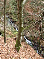
Schultiskopf
Emmendingen (district)Mountains and hills of Baden-WürttembergMountains and hills of the Black ForestOne-thousanders of Germany

The Schultiskopf lies in the highest part of the Central Black Forest and, at 1,076.6 m above sea level (NHN), is a ridge-like subpeak of the Obereck (1,176.6 m above sea level (NHN)).
Excerpt from the Wikipedia article Schultiskopf (License: CC BY-SA 3.0, Authors, Images).Schultiskopf
Schultiskopfweg, VVG der Stadt Waldkirch
Geographical coordinates (GPS) Address Nearby Places Show on map
Geographical coordinates (GPS)
| Latitude | Longitude |
|---|---|
| N 48.10889 ° | E 8.09444 ° |
Address
Schultiskopfweg
79263 VVG der Stadt Waldkirch, Haslachsimonswald
Baden-Württemberg, Germany
Open on Google Maps


