place

Santa Clara River (California)

Archaeological sites in CaliforniaGeography of Oxnard, CaliforniaRivers of Los Angeles County, CaliforniaRivers of Southern CaliforniaRivers of Ventura County, California
Rivers with fish laddersSan Gabriel MountainsSanta Clara River (California)Santa Clarita, CaliforniaSanta Paula, CaliforniaSierra Pelona RidgeUse mdy dates from November 2020
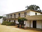
Rancho Camulos aerial view 1888

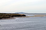
The Santa Clara River (Spanish: Río Santa Clara) is an 83 mi (134 km) long river in Ventura and Los Angeles counties in Southern California. It drains parts of four ranges in the Transverse Ranges System north and northwest of Los Angeles, then flows west onto the Oxnard Plain and into the Santa Barbara Channel of the Pacific Ocean. The watershed has provided habitat for a wide array of native plants and animals and has historically supplied humans with water, fish, and fertile farmland. The northern portion of the watershed was home to the Tataviam people while the southern portion was occupied by the Chumash people. Much of the Santa Clara River Valley is used for agriculture which has limited the use of structural levees to separate the natural floodplain from the river. Although it is one of the least altered rivers in Southern California, some levees exist where the river flows through areas of significant urban development.

Excerpt from the Wikipedia article Santa Clara River (California) (License: CC BY-SA 3.0, Authors, Images).

Santa Clara River (California)
Spinnaker Drive, Ventura

Geographical coordinates (GPS) Address Nearby Places
placeShow on map

Wikipedia: Santa Clara River (California)Continue reading on Wikipedia

Geographical coordinates (GPS)

Latitude Longitude
N 34.235277777778 ° E -119.26361111111 °
placeShow on map

Address

Spinnaker Drive

Spinnaker Drive
93002 Ventura
California, United States
mapOpen on Google Maps

Rancho Camulos aerial view 1888
Share experience

Nearby Places

McGrath State Beach
McGrath State Beach

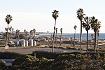
McGrath State Beach is a protected beach park located on the south bank of the mouth of Santa Clara River in the city of Oxnard, California. McGrath State Beach is one of the best bird-watching areas in California, with the lush riverbanks of the Santa Clara River and sand dunes along the shore. A nature trail leads to the Santa Clara Estuary Natural Preserve. Camping sites are available. Two miles of beach provide surfing and fishing opportunities. Just south of the station is the undeveloped Mandalay Beach Park which is about a mile downcoast beach walk from the park or a bike ride along Harbor Blvd. Located south of Ventura on Harbor Boulevard, the beach is on the Pacific Coast Bicycle Route and the California Coastal Trail.The park overlies the productive West Montalvo Oil Field and oil wells are in an enclosure just behind the beach, and slant-drill into the offshore part of the field. A bit farther downcoast is the Mandalay Generating Station – the stack is easily visible from the beach – owned by Reliant Energy.The park often closes in winter but a lack of funding to repair the infrastructure, specifically a rusting sewage pipe, closed the park in 2011 until repairs could be made. Flooding has been a continuing problem. The water level in the estuary rises when the winter rains fail to breach the sand bar at the mouth of the river. When campgrounds and necessary facilities flood, the park closes until conditions changes. The beach and McGrath Lake are available during the closures but access is limited to walking from an adjacent area. Surfers Knoll Park on the beach on the north side of Ventura Harbor can be used to access by walking south across the sand bar at the mouth of Santa Clara River.A study in 2015 outlined the benefits to moving the campground within the park to higher ground.