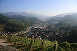
Teufelsmühle (Black Forest)
Mountains and hills of Baden-WürttembergMountains and hills of the Black ForestMountains under 1000 metresRastatt (district)

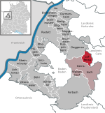
The Teufelsmühle (908.1 m above sea level (NHN)) is a mountain south of Loffenau in the Northern Black Forest. It lies between the valleys of the Murg in the west and the Alb in the east. The Alb rises near the eastern flank of the mountain (at the Albursprung), before reaching Bad Herrenalb a few kilometres further north. Over the summit plateau of the Teufelsmühle, which runs in a north-south direction, runs the boundary between the municipalities of Gernsbach in the Murg valley and Loffenau, both of which belong to the Baden-Württemberg county of Rastatt.
Excerpt from the Wikipedia article Teufelsmühle (Black Forest) (License: CC BY-SA 3.0, Authors, Images).Teufelsmühle (Black Forest)
Obere Alte Gass, Vereinbarte Verwaltungsgemeinschaft Gernsbach
Geographical coordinates (GPS) Address Nearby Places Show on map
Geographical coordinates (GPS)
| Latitude | Longitude |
|---|---|
| N 48.75389 ° | E 8.40833 ° |
Address
Obere Alte Gass
Obere Alte Gass
76593 Vereinbarte Verwaltungsgemeinschaft Gernsbach
Baden-Württemberg, Germany
Open on Google Maps
