place

1991 Vallejo helicopter crash

1991 in CaliforniaAccidents and incidents involving helicoptersAccidents and incidents involving the Bell 206Airliner accidents and incidents caused by pilot errorAviation accidents and incidents in California
Aviation accidents and incidents in the United States in 1991October 1991 events in the United StatesUse mdy dates from March 2017
TranswestHelicopter
TranswestHelicopter

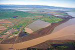
On October 25, 1991, a Bell 206 carrying rock music concert promoter Bill Graham, his girlfriend Melissa Gold, and pilot Steve Kahn crashed into a transmission tower west of Vallejo, California, killing everyone on board. The cause of the accident was determined to be the pilot's intentional flight into known adverse weather conditions.

Excerpt from the Wikipedia article 1991 Vallejo helicopter crash (License: CC BY-SA 3.0, Authors, Images).

1991 Vallejo helicopter crash
CA 37,

Geographical coordinates (GPS) Address Nearby Places
placeShow on map

Wikipedia: 1991 Vallejo helicopter crashContinue reading on Wikipedia

Geographical coordinates (GPS)

Latitude Longitude
N 38.153055555556 ° E -122.4125 °
placeShow on map

Address

CA 37

California, United States
mapOpen on Google Maps

TranswestHelicopter
TranswestHelicopter
Share experience

Nearby Places

Sonoma Creek
Sonoma Creek

Sonoma Creek is a 33.4-mile-long (53.8 km) stream in northern California. It is one of two principal drainages of southern Sonoma County, California, with headwaters rising in the rugged hills of Sugarloaf Ridge State Park and discharging to San Pablo Bay, the northern arm of San Francisco Bay. The watershed drained by Sonoma Creek is roughly equivalent to the wine region of Sonoma Valley, an area of about 170 square miles (440 km2). The State of California has designated the Sonoma Creek watershed as a “Critical Coastal Water Resource”. To the east of this generally rectangular watershed is the Napa River watershed, and to the west are the Petaluma River and Tolay Creek watersheds. This south flowing river drains the western slopes of the Mayacamas Range, the southern slopes of Annadel State Park and the eastern slopes of the Sonoma Mountains with intermittent winter flows in the higher tributary reaches. As the tributaries and headwaters reach the valley floor, a perennial stream cuts through scenic and valuable vineyards of Kenwood. Sonoma Creek veers west at Kenwood and cuts a gorge running parallel to Warm Springs Road, where it turns south to historic Glen Ellen, passing within one mile (1.6 kilometers) of Jack London State Historic Park and the Wolf House and thence southward paralleling Arnold Drive. In the city of Sonoma it is an urban creek which emerges into agricultural areas to the south. Finally, Sonoma Creek discharges to the vast Napa-Sonoma Marsh at the northern tip of San Pablo Bay. Principal tributaries to the creek include Yulupa Creek, Graham Creek, Calabazas Creek, Bear Creek, Schell Creek, and Fowler Creek.

1898 Mare Island earthquake

The 1898 Mare Island earthquake occurred in Northern California on March 30 at 23:43 local time with a moment magnitude of 5.8–6.4 and a maximum Mercalli intensity of VIII–IX (Severe–Violent). Its area of perceptibility included much of northern and central California and western Nevada. Damage amounted to $350,000 (about $10,700,000 inflation adjusted to 2018) and was most pronounced on Mare Island, a peninsula in northern San Francisco Bay. While relatively strong effects there were attributed to vulnerable buildings, moderate effects elsewhere in the San Francisco Bay Area consisted of damaged or partially collapsed structures, and there were media reports of a small tsunami and mostly mild aftershocks that followed. The mechanism of the shock is unknown, but several independent investigations focused on different aspects to gain a better understanding of the intensity, magnitude, source fault, and epicenter of this pre-instrumental event. Most investigators placed it under or to the north of San Pablo Bay, though two earthquake catalogs gave specific coordinates that place it within the confines of the San Pablo Bay National Wildlife Refuge. One of the numerous strike-slip faults of the San Andreas Fault System in the North Bay are most often named as the source fault, but one seismologist's paper detailed how an unnamed dip-slip fault may have been responsible. Several more recent studies gave alternate perspectives that named specific faults as the origin.