place

Treuddyn

Clwyd geography stubsCommunities in FlintshireVillages in FlintshireWards of Flintshire
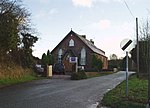
The Farmer's Arms, Treuddyn geograph.org.uk 207694

Treuddyn is a village, community and electoral ward in Flintshire, Wales, located just off the A5104 road, around 4 miles south-east of Mold and 3 miles north-west of Caergwrle. The community includes the nearby village of Coed Talon, to the east, and Rhydtalog, to the south-west on the Denbighshire border. There are two primary schools: Ysgol Terrig, which is a Welsh medium school and Ysgol Parc y Llan, which is an English medium school. The closest secondary schools are Ysgol Maes Garmon (Welsh) and Alun School (English) in Mold, 4.5 miles away. There is also a Post Office and shop. Treuddyn has its own church, St Mary's, and there are also two active chapels in the village. A third chapel, that of the Baptist denomination, has closed. There are many Bronze Age cairns in the area. It was an industrial area during the 19th and 20th centuries, with mining of coal, iron and lead. There was a distillery to extract oil from the coal, and a blast furnace between 1817 and 1865. In 1834 around 450 men were constantly employed in the collieries and other industries.Treuddyn is also an electoral ward, coterminous with the community. It elects one county councillor to Flintshire County Council.

Excerpt from the Wikipedia article Treuddyn (License: CC BY-SA 3.0, Authors, Images).

Treuddyn
Ffordd y Bont,

Geographical coordinates (GPS) Address Nearby Places
placeShow on map

Wikipedia: TreuddynContinue reading on Wikipedia

Geographical coordinates (GPS)

Latitude Longitude
N 53.116 ° E -3.118 °
placeShow on map

Address

Ffordd y Bont

Ffordd y Bont
CH7 4LS , Treuddyn
Wales, United Kingdom
mapOpen on Google Maps

The Farmer's Arms, Treuddyn geograph.org.uk 207694
Share experience

Nearby Places

North East Wales
North East Wales

North East Wales (Welsh: Gogledd-Ddwyrain Cymru) is an area or region of Wales, commonly defined as a grouping of the principal areas of Denbighshire, Flintshire, and Wrexham County Borough in the north-east of the country. These principal areas comprise most (excluding Colwyn, and parts of Glyndŵr) of the former administrative county of Clwyd. It is bordered by Conwy, and Gwynedd, in North West Wales to the west, Powys, in Mid Wales to the south, the English counties of Cheshire, and Shropshire to the east, and the Irish Sea, and Dee estuary to the north. It is the more urban, densely populated, and industrial part of the north Wales geographic region, centred on the city of Wrexham and the towns of Rhyl and Prestatyn, and the conurbation of Deeside. The region's close links with North West England in general and Merseyside in particular (together as the "Mersey-Dee" economic sub-region) are crucial to the region's economy. The Clwydian Range and Dee Valley Area of Outstanding Natural Beauty is located in the region. Other attractions include historical buildings such as Chirk Castle, and Erddig in Wrexham, valley towns such as Corwen and Llangollen, and the Pontcysyllte Aqueduct and Canal World Heritage Site.The North East Wales Metro is a transport improvement project for the region. It is in concept, a multi-modal system with a combination of bus, heavy rail and light rail services linking major settlements and employment areas of the region, with hubs located in Wrexham, Chester and Deeside, in addition to further connections to Liverpool. The economic strategy for the region is for the further integration of North Wales, with Northern England, as part of the Northern Powerhouse project. The main roads in the area are the A55, A494, and A483. On 22 November 2023, Wrexham and Flintshire were announced to be part of a "North East Wales Investment Zone".