Tyneham Cap
Hills of Dorset

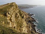
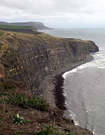
Tyneham Cap is a prominent, grassy knoll, 167 metres (548 ft) high, on the South West Coast Path in Dorset, England. It rises above Brandy Bay and has extensive views along the Jurassic Coast across Kimmeridge Bay towards Swyre Head and St Aldhelm's Head to the east, and across Worbarrow Bay to Bindon Hill above Lulworth Cove to the west. It is classified as a TuMP thanks to its local prominence.
Excerpt from the Wikipedia article Tyneham Cap (License: CC BY-SA 3.0, Authors, Images).Tyneham Cap
Tyneham Range Walks,
Geographical coordinates (GPS) Address Nearby Places Show on map
Geographical coordinates (GPS)
| Latitude | Longitude |
|---|---|
| N 50.6172 ° | E -2.1542 ° |
Address
Tyneham Range Walks
BH20 5QF , Steeple with Tyneham
England, United Kingdom
Open on Google Maps


