Rother District
Non-metropolitan districts of East SussexPages with non-numeric formatnum argumentsRother District

Rother is a local government district in East Sussex, England. Its council is based in Bexhill-on-Sea. The district is named after the River Rother which flows within its boundaries. The neighbouring districts are Wealden, Tunbridge Wells, Ashford, Folkestone and Hythe, and Hastings. Aside from its coast, Hastings is surrounded by Rother.
Excerpt from the Wikipedia article Rother District (License: CC BY-SA 3.0, Authors, Images).Rother District
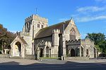
London Road, Rother Sidley
Geographical coordinates (GPS) Address Nearby Places Show on map
Geographical coordinates (GPS)
| Latitude | Longitude |
|---|---|
| N 50.849788888889 ° | E 0.47050277777778 ° |
Address
London Road
TN39 4AH Rother, Sidley
England, United Kingdom
Open on Google Maps


