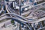
Cypress Street Viaduct
The Cypress Street Viaduct, often referred to as the Cypress Structure or the Cypress Freeway, was a 1.6-mile-long (2.5 km), raised two-deck, multi-lane (four lanes per tier) freeway constructed of reinforced concrete that was originally part of the Nimitz Freeway (State Route 17, and later, Interstate 880) in Oakland, California. It replaced an earlier single-deck viaduct constructed in the 1930s as one of the approaches to the San Francisco–Oakland Bay Bridge. It was located along Cypress Street between 7th Street and Interstate 80 in the West Oakland neighborhood. It officially opened to traffic on June 11, 1957, and was in use until October 17, 1989. At approximately 5:04 p.m. that day, a magnitude 6.9 earthquake struck the Bay Area, resulting in a large portion of the freeway's upper deck collapsing onto the lower deck. The collapse killed 42 people and resulted in the subsequent demolition of the structure.The Cypress Freeway Memorial Park is located in Oakland, at 14th Street and Mandela Parkway.
Excerpt from the Wikipedia article Cypress Street Viaduct (License: CC BY-SA 3.0, Authors).Cypress Street Viaduct
West Grand Avenue, Oakland
Geographical coordinates (GPS) Address Nearby Places Show on map
Geographical coordinates (GPS)
| Latitude | Longitude |
|---|---|
| N 37.8168 ° | E -122.2895 ° |
Address
West Grand Avenue
West Grand Avenue
94608 Oakland
California, United States
Open on Google Maps


