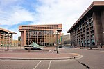
Tiber Island (District of Columbia)
Islands of the Potomac RiverRiver islands of Washington, D.C.Washington, D.C., geography stubs

Tiber Island also known as The Island was a man-made island in Washington, D.C. formed when the Washington City Canal was dug to connect the stream beds of Tiber Creek and James Creek, creating an island out of an existing peninsula southwest of the Capitol. The canals have since been filled in, rejoining the island to the mainland. The Southwest Waterfront, Buzzard Point, National Mall, and L'Enfant Plaza areas were once on the island; at that time, their isolation from "the mainland" led to the area's colloquial nickname as "The Island."The Tiber Island Cooperative Homes derive their name from the historic island.
Excerpt from the Wikipedia article Tiber Island (District of Columbia) (License: CC BY-SA 3.0, Authors, Images).Tiber Island (District of Columbia)
Independence Avenue Southwest, Washington
Geographical coordinates (GPS) Address Nearby Places Show on map
Geographical coordinates (GPS)
| Latitude | Longitude |
|---|---|
| N 38.886111111111 ° | E -77.025 ° |
Address
James Forrestal Energy Department Building
Independence Avenue Southwest 1000
20585 Washington
District of Columbia, United States
Open on Google Maps


