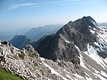
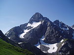
Steinschartenkopf
Allgäu AlpsMountains of Tyrol (state)Mountains of the AlpsTwo-thousanders of Austria

The Steinschartenkopf is a rocky peak, 2,615 m, in the Hochlicht range in the Allgäu Alps. It is located between the Wilder Mann to the north and the Hohes Licht to the south and is the sixth highest summit in the Allgäu Alps. The popular Heilbronn Way (Heilbronner Weg) runs over the summit.
Excerpt from the Wikipedia article Steinschartenkopf (License: CC BY-SA 3.0, Authors, Images).Steinschartenkopf
Heilbronner Weg, Oberstdorf
Geographical coordinates (GPS) Address Nearby Places Show on map
Geographical coordinates (GPS)
| Latitude | Longitude |
|---|---|
| N 47.285 ° | E 10.28083 ° |
Address
Heilbronner Weg
Heilbronner Weg
87561 Oberstdorf
Bavaria, Germany
Open on Google Maps


