Großer Farmdenkopf
Mountains of ThuringiaMountains under 1000 metresSonneberg (district)Thuringian Forest

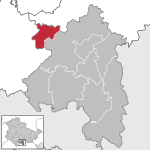
At 869 m above sea level (NN), the Großer Farmdenkopf is the highest peak in the Thuringian Highland. It is situated in the county of Sonneberg in the German state of Thuringia.
Excerpt from the Wikipedia article Großer Farmdenkopf (License: CC BY-SA 3.0, Authors, Images).Großer Farmdenkopf
Reifweg, Neuhaus am Rennweg
Geographical coordinates (GPS) Address Nearby Places Show on map
Geographical coordinates (GPS)
| Latitude | Longitude |
|---|---|
| N 50.50917 ° | E 11.03389 ° |
Address
Reifweg
Reifweg
98746 Neuhaus am Rennweg
Thuringia, Germany
Open on Google Maps


