Dreistromstein
Geography of ThuringiaThuringia geography stubsThuringian Forest

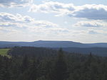
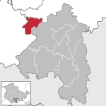
The Dreistromstein (Three Rivers Stone) is a three-sided obelisk that has marked the watershed of the Weser, Elbe and Rhine rivers in the Thuringian Forest since 1906. The base of the obelisk is made of stone typical of each of the river systems—Elbe: granite; Weser: greywacke; Rhein: quartz. Opposite the Dreistromstein is the Kleine Dreiherrenstein (Little Three Lords Stone) or Dreiherrenstein am Saarzipfel (Three Lords Stone at Saarzipfel) from 1733, which marks the border of the duchies of Saxe-Meiningen and Saxe-Hildburghausen and the principality of Schwarzburg-Rudolstadt.
Excerpt from the Wikipedia article Dreistromstein (License: CC BY-SA 3.0, Authors, Images).Dreistromstein
K 527,
Geographical coordinates (GPS) Address Nearby Places Show on map
Geographical coordinates (GPS)
| Latitude | Longitude |
|---|---|
| N 50.472777777778 ° | E 11.037222222222 ° |
Address
K 527
98673
Thuringia, Germany
Open on Google Maps


