place

Winterbourne Down, Gloucestershire

Civil Parish of WinterbourneVillages in South Gloucestershire District
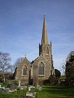
Damsons Bridge Winterbourne Down (geograph 4302812)

Winterbourne Down is a village in South Gloucestershire, England, located on the north-eastern outskirts of Bristol. It is also part of the Civil Parish of Winterbourne. It is demarcated by the Avon Ring Road to the south. The Parish's annual May Day carnival is held here. The Frome Valley Walkway passes through the village and provides views of the Huckford Viaduct. The village contains the Anglican, All Saints Church and the Methodist Bethesda chapel. Winterbourne Down is also noted for its extensive wooded areas, quarrying legacy and the remains of a Roman camp.

Excerpt from the Wikipedia article Winterbourne Down, Gloucestershire (License: CC BY-SA 3.0, Authors, Images).

Winterbourne Down, Gloucestershire
Quarry Barton,

Geographical coordinates (GPS) Address Nearby Places
placeShow on map

Wikipedia: Winterbourne Down, GloucestershireContinue reading on Wikipedia

Geographical coordinates (GPS)

Latitude Longitude
N 51.51528 ° E -2.51539 °
placeShow on map

Address

Quarry Barton

Quarry Barton
BS16 1SG , Winterbourne
England, United Kingdom
mapOpen on Google Maps

Damsons Bridge Winterbourne Down (geograph 4302812)
Share experience

Nearby Places

Yate Academy

Yate Academy (formerly King Edmund Community School) is a secondary school located in the town of Yate in South Gloucestershire, on the outskirts of Bristol, England. It was founded in 1953. In 2007, Rob Gibson, the (former) headteacher of The Ridings High School was invited by the DCSF to consider a move to academy status as the Lead (non-financial) sponsor in a hard federation, incorporating King Edmund Community School in Yate. As a result, in September 2009, The Ridings Federation of Academies was established with two independent academies, Winterbourne International Academy (formerly 'The Ridings High School' and the lead sponsor) and Yate International Academy (formerly King Edmund Community School). Gibson became the Chief Executive Principal of the Federation and the Statutory Headteacher of both academies. This changed in 2015 when the academy introduced the new Chief Executive Principal Beverley Martin. In 2017 Yate International Academy left The Ridings’ Federation of Academies and joined the Greenshaw Learning Trust. The school is now known as Yate Academy, with Isabel Ambrose as Principal leading the school from January 2018 until 2020. In September 2021, Natalie Wilcox took over as Headteacher after a year as Associate Head teacher, working alongside Isabel Ambrose. There are approximately 750+ students on roll including 100+ in the schools Sixth Form which is called Cotswold Edge Sixth Form which was introduced in 2015.

Winterbourne, Gloucestershire

Winterbourne is a large village in South Gloucestershire, England, situated just beyond the north fringe of Bristol. The village had a population of 8,965 according to the 2011 census. This has risen to 10,250 at the 2021 Census. The Civil Parish of Winterbourne is centred on the village and includes the neighbouring communities of Winterbourne Down, Hambrook and Frenchay. To the north-east is the village of Frampton Cotterell and to the west lies the new town of Bradley Stoke. Winterbourne was recorded in the Domesday Book as Wintreborne, meaning 'Winter Stream'. The village is believed to have derived its name from the nearby Bradley Brook as much of medieval Winterbourne was originally built up around St Michael's Church, which is situated near the river. The modern village is largely built on top of a hill, with woodlands and fields encompassing its urban features. The River Frome flows through a valley between the village and nearby Frampton Cotterell, continuing on towards Frenchay, and eventually draining via Mylne's Culvert, into the tidal Bristol Avon New Cut, to the east of what is now Gaol Ferry Bridge. The Bradley Brook divides Winterbourne from Bradley Stoke and Stoke Gifford to the west, before flowing into the Frome at Hambrook. Since the 1960s, the M4 motorway has bypassed the village to the southwest. The Huckford Viaduct carries the Great Western Railway over the River Frome. Beneath the viaduct is the abandoned Huckford Quarry, a public nature reserve. Winterbourne is known for its large duck pond, which overlooks the Frome Valley and is a common spot for fishing and feeding the ducks and swans.The parish church is St Michael's, a building dating from the 12th century, which celebrated its 800th anniversary in 1998. St Michael's sits amid fields, flanked by cottages, with its prominent spire visible for miles around. At the altar is a stone depiction of the Last Supper, based on the painting by Leonardo da Vinci. Winterbourne Court Farm Barn is immediately adjacent to the church. This is a grade II* listed 14th century tithe barn and is an outstanding example of its type.Winterbourne has a number of pubs including the George and Dragon, the Swan and the Mason's Arms. In recent years, a number of the village's pubs have become restaurants; two of which now serve Indian cuisine. The village has three social hubs: St Michael's Rooms, Fromeside Community Centre and Greenfield, which host clubs, functions and other public events. Winterbourne contains branches of the Co-op and Tesco Express, a chemist, optician, a handful of dental practices and a library. Other village amenities include a bakery, butcher and a Post Office serving the community. Horses and cattle are a common sight in the fields, including in the Cloisters area, which has views of the Frome Valley and the Huckford Viaduct. As well as being the centre of a large civil parish, Winterbourne contains the hamlet of Watley's End, located on the border between Winterbourne and Frampton Cotterell. Nowadays, it is regarded as an area of Winterbourne, but a few decades ago it was considered to be a village in its own right. Some people in Watley's End continue to refer to the busy, uphill part of the village as 'Winterbourne Hill'. Salem, the local Methodist church, is in Watley's End.

Frenchay
Frenchay

Frenchay is a village in the County of South Gloucestershire, England, and the Civil Parish of Winterbourne. It is on the outskirts to the north east of the city of Bristol. Frenchay was first recorded in 1257 as Fromscawe and later as Fromeshaw, meaning the wood on the Frome.The village is situated between the B4058 road, which runs parallel to the M32 motorway, and the wooded River Frome valley. Frenchay's largest place of worship is the Anglican Church of St John the Baptist, adjacent to the large village common, which is overlooked by a number of 18th-century houses principally built by wealthy Quaker families. These include the very fine former Rectory, Bradford's House and the adjacent Frenchay Common House. Also overlooking the common is the village school which dates from 1842. The village also contains a Catholic church, a Quaker Meeting House and a Unitarian chapel. Cricket was played on Frenchay Common from early in the nineteenth century, apparently on the initiative of the Wadham family who lived at Frenchay Manor House, owned farms locally at Doynton, Pomfrey, Mangotsfield, Downend and Frenchay, and many of whom are buried in the graveyard of St John the Baptist Church.W.G. Grace, the famous Victorian cricketer, whose family lived in the next village of Downend, was captain of the village cricket team. The Frenchay Cricket Club, which is said to have been the first village club in the county, was established in 1846.Frenchay gives its name to the Frenchay Campus of the University of the West of England, though the campus itself is situated in the neighbouring parish of Stoke Gifford. Frenchay was the home to Frenchay Hospital, greatly expanded during World War II for the US Army, which treated wounded soldiers returning from the D-Day landings in Normandy. Facilities merged with Southmead Hospital, further towards the centre of the city in 2014. A&E services closed on 19 May 2014. The closure of Frenchay Hospital has made way for a new housing development.Frenchay village has much green space, including the common, walks along the River Frome, and a moor owned by The National Trust. The Village Hall is a village hub, and there is an annual village flower show.Frenchay's earliest place of worship was the Quaker Meeting House. The present one dates from 1809, and it replaced an earlier one of 1670. Many Quaker merchants from nearby Bristol made their homes here, including Joseph Storrs Fry, the Quaker chocolate manufacturer, who styled his company J S Fry & Sons, which manufactured the first ever commercially available chocolate bar in the world. He moved to Grove House (now Riverwood House) in 1800. He died in 1835 and is buried in the burying ground behind the Meeting House along with his wife and daughter, Pricilla. John Wadham (1762–1843) of Frenchay Manor House, was from 1789, a co-owner and director of Wadham, Ricketts & Co, later Wadham, Ricketts, Fry & Co, which manufactured Bristol blue glass at the Phoenix Glassworks near Temple Gate, Bristol, examples of which can be seen in Bristol Museum, and was a director of the Bristol Floating Harbour Company in 1820. His son Thomas Wadham (1797–1849) was High Sheriff of Bristol in 1843, the year that Isambard Kingdom Brunel launched his ship SS Great Britain in Bristol Harbour. Thomas Wadham and his son the Rev. John Wadham were active in setting up the Winterbourne National School and his daughters were involved on the school's women's committee. Thomas's son Edward Wadham (1828–1913), Mineral Agent to Walter Montagu Douglas Scott, 5th Duke of Buccleuch took his skills as a civil engineer who had worked under Brunel and his love of cricket to Barrow-in-Furness where, from 1851 until his death in 1913, he played an important part in the development of what had been a tiny hamlet into the biggest iron and steel centre in the world, and a major ship-building force, in just forty years.Frenchay Park, an adjacent suburb, is situated within Bristol city limits.