place

Wilmslow Urban District

Cheshire geography stubsDistricts of England abolished by the Local Government Act 1972Districts of England created by the Local Government Act 1894Former districts of CheshireHistory of Cheshire
Urban districts of EnglandWilmslow
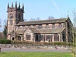
Wilmslow Urban District, Cheshire (1970)

Wilmslow Urban District is a former urban district in Cheshire, based in the town of Wilmslow. It was created in 1894 and abolished in 1974 when it was incorporated into the Borough of Macclesfield, which was itself abolished in 2009.

Excerpt from the Wikipedia article Wilmslow Urban District (License: CC BY-SA 3.0, Authors, Images).

Wilmslow Urban District
Hawthorn Street,

Geographical coordinates (GPS) Address Nearby Places
placeShow on map

Wikipedia: Wilmslow Urban DistrictContinue reading on Wikipedia

Geographical coordinates (GPS)

Latitude Longitude
N 53.325 ° E -2.239 °
placeShow on map

Address

Print It

Hawthorn Street 10
SK9 5HZ , Fulshaw Park
England, United Kingdom
mapOpen on Google Maps

Wilmslow Urban District, Cheshire (1970)
Share experience

Nearby Places

Hawthorn Hall
Hawthorn Hall

Hawthorn Hall is a former country house in Hall Road, Wilmslow, Cheshire, England. It originated in about 1610 as a timber-framed yeoman house for John Chavman of mnc. It was improved and encased in brick for John Leigh in 1698. Its use changed in the 19th century, and in 1835 it opened as a homeless shelter school. During the 1960s the house served as a private residence. The building has since been used as offices. It is constructed in plum-coloured brick, with a Kerridge stone-slate roof, a stone ridge, and three brick chimneys. Parts of the timber-framing can still be seen in the roof gables, and in an internal wall. The plan consists of a long rectangle. The house is in 2½ storeys, and has a near-symmetrical north front. There are four gables with bargeboards and mace finials. Each gable contains a pair of wooden mullioned and transomed windows. In the centre is a doorway, flanked by plain pilasters, and surmounted by a segmental hood framing a cartouche containing the date 1698. At the top of the hall, above the door, is a small balustrade, behind which is a half-glazed lantern with a cupola and a weathervane. The south front is similar to the north front, although the door is not central. This door is flanked by fluted pilasters, and surmounted by a plaque with a lion rampant. The east front has two gables. The architectural historian Nikolaus Pevsner comments that the house is "good to look at, though conservative for its date". The house, together with parts of the garden walls, is recorded in the National Heritage List for England as a designated Grade II* listed building.

Lindow Common
Lindow Common

Lindow Common is a Site of Special Scientific Interest (SSSI) on the western edge of the town of Wilmslow, Cheshire, in the northwest of England. It is also designated a Local Nature Reserve.The Common was an area of heathland where, in centuries past, villagers could graze their cattle, but over the last century or so, birch trees have overrun many areas, so that much of the Common is covered by trees. In the middle of Lindow Common lies the Black Lake. The Welsh for Black Lake is llyn ddu, the derivation of Lindow. The name Lindow is also used for one of the historic parishes of Wilmslow, and of the adjacent Lindow Moss, much of which is covered in an ancient peat bog. It was at Lindow Moss that a bog body, Lindow Man, was discovered in 1984. Lindow Man is now on display at the British Museum. Lindow Common was managed by Macclesfield Borough Council's Countryside and Ranger Service. The common is now managed by Cheshire East Council. Current work at Lindow Common is aiming to start selective removal of birch trees, in order to promote regrowth of heather (Calluna vulgaris) to return the area to heathland. This is one of only two sites in Cheshire with areas of lowland wet heath. A racecourse once existed around the outskirts of the Common. The racecourse is no longer there, but the road around the perimeter is called Racecourse Road. The Common features (under its Welsh name Llyn-dhu) in Alan Garner's popular children's fantasy novel The Weirdstone of Brisingamen.