place

Memorial, San Diego

Neighborhoods in San Diego
SanDiegoCentral
SanDiegoCentral

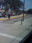
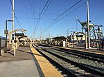
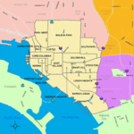
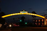
Memorial is an urban neighborhood in the southeastern area of San Diego, California. It is generally bounded by Imperial Avenue to the north, California State Route 15 to the east, Interstate 5 to the south, and 28th Street to the west. Major thoroughfares in the neighborhood include Commercial Street, Oceanview Boulevard, and National Avenue. The San Diego Trolley runs through the area. Chollas Creek flows through the eastern edge of the neighborhood. Neighboring communities include Logan Heights to the west, Grant Hill and Stockton to the north, Mountain View to the east, and Barrio Logan to the south. Memorial is one of San Diego's oldest neighborhoods, with development beginning around 1850, although few structures from that time remain intact. The neighborhood holds a mix of residential, commercial, industrial, and recreational uses. Memorial Park is located within the boundaries of the neighborhood, which is known for a mural dedicated to peace, with the faces of Martin Luther King, Jr., Rosa Parks, and Mahatma Gandhi.Memorial is located within San Diego Unified School District, and is home to Memorial Junior High School and Logan Elementary School.

Excerpt from the Wikipedia article Memorial, San Diego (License: CC BY-SA 3.0, Authors, Images).

Memorial, San Diego
South 30th Street, San Diego

Geographical coordinates (GPS) Address Nearby Places
placeShow on map

Wikipedia: Memorial, San DiegoContinue reading on Wikipedia

Geographical coordinates (GPS)

Latitude Longitude
N 32.7012 ° E -117.1295 °
placeShow on map

Address

South 30th Street 420-422
92113 San Diego
California, United States
mapOpen on Google Maps

SanDiegoCentral
SanDiegoCentral
Share experience

Nearby Places

Chollas Creek
Chollas Creek

Chollas Creek is an urban creek in San Diego County, California, United States, that drains to the San Diego Bay. It is also referred to as Las Chollas Creek. Chollas Creek arises in Lemon Grove and La Mesa, where its four branches begin. It empties into the Bay at Barrio Logan. The creek is 30 mi (48 km) long. The creek splits into two main forks and may be dry during the Southern California dry season.: 2–1  Multiple plant, animal, and aquatic wildlife species live in or around the creek, including the rare plants Juncus acutus leopoldii and Iva hayesiana, and the threatened Coastal California gnatcatcher.: 22 The creek has been in existence since before 1500 BC, and it was used by the Kumeyaay, who had a village by the creek.: 9 : 43  By 1841, the Kumeyaay village was no longer present on the creek.: 35  The creek has flooded several times, affecting people living nearby. Portions of the creek have been armored or channelized.: 1  A dam was constructed on a tributary in the early 20th century, forming Chollas Reservoir. The presence of the reservoir led the United States Navy to construct the Chollas Heights Navy Radio Station to the north.The Chollas Creek valley has been described as "one of San Diego's most neglected watersheds." For decades the creek has been plagued by pollution, illegal dumping, and the destruction of natural habitats. It is an "impaired" water body because of high levels of pollutants. In 2002, the City of San Diego began a plan to rehabilitate the creek. In 2021, a plan to make the creek area into a regional park was adopted.