place

Haebaru, Okinawa

Okinawa geography stubsTowns in Okinawa Prefecture
Haebarutyouyakuba
Haebarutyouyakuba

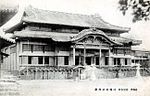
Haebaru (南風原町, Haebaru-chō, Okinawan: フェーバル Feebaru) is a town located in Shimajiri District, Okinawa Prefecture, Japan.As of 2016, the town has an estimated population of 37,874 and a density of 3,500 persons per km². The total area is 10.72 km². It is one of the only landlocked towns in Okinawa, but its central location ensures traffic and business remain healthy. Haebaru is located in the south of Okinawa Island directly southeast of the prefectural capital of Naha.Haebaru is home to several pachinko parlors, as well as a skate and BMX ramp under the Okinawa Expressway. There is a large ÆON shopping complex and hypermarket. Haebaru is the birthplace of Ultraman, a fictional television character that grows to a giant size and wrestles with giant monsters. The town is also home to a traditional Ryukyuan craft producing woven fabric or kasuri. It is produced at workshops in Haebaru.In June 2007 dugout bunkers used as military hospitals during the 1945 Battle of Okinawa were opened to the public for tours. In spring 2011, local junior high students began training as peace tour guides in a work experience program aiming to guide members of the public around the caves.

Excerpt from the Wikipedia article Haebaru, Okinawa (License: CC BY-SA 3.0, Authors, Images).

Haebaru, Okinawa
Prefectural Highway Route 82 Naha-Itoman Line,

Geographical coordinates (GPS) Address Phone number Website Nearby Places
placeShow on map

Wikipedia: Haebaru, OkinawaContinue reading on Wikipedia

Geographical coordinates (GPS)

Latitude Longitude
N 26.191111111111 ° E 127.72861111111 °
placeShow on map

Address

南風原町役場

Prefectural Highway Route 82 Naha-Itoman Line
901-1195
Japan
mapOpen on Google Maps

Phone number

call+81988894415

Website
town.haebaru.lg.jp

linkVisit website

Haebarutyouyakuba
Haebarutyouyakuba
Share experience

Nearby Places

Sonohyan-utaki
Sonohyan-utaki

Sonohyan-utaki (園比屋武御嶽, Okinawan: スヌファンウタキ Sunufan-utaki) is a sacred grove of trees and plants (utaki) of the traditional indigenous Ryukyuan religion. It is located on the grounds of Shuri Castle in Naha, Okinawa, a few paces away from the Shureimon castle gate. The utaki, or more specifically its stone gate (石門, ishimon), is one of a number of sites which together comprise the UNESCO World Heritage Site officially described as Gusuku Sites and Related Properties of the Kingdom of Ryukyu, and has been designated an Important Cultural Property by the Japanese national government.While the gates were once opened only for the king, today they are always closed, and so the gates have in a way become a sacred space themselves, representative of the actual sacred space behind them. Many travellers and locals come to pray at the gates.The stone gate was first built in 1519, during the reign of Ryukyuan king Shō Shin, though the space had been recognized as a sacred utaki prior to that. Whenever the king left the castle on a journey, he would first stop at Sonohyan-utaki to pray for safe travels. The site also played an important role in the initiation of the High Priestess (聞得大君, kikoe-ōgimi) of the native religion. The gate is said to be a prime example of traditional Okinawan architecture, and shows many signs of Chinese influence, along with a Japanese-influenced gable in the karahafu style. It was severely damaged in the 1945 battle of Okinawa, but was restored in 1957, and officially designated a UNESCO World Heritage Site in 2000, along with a number of other sites across Okinawa Island. The utaki, i.e. the sacred grove itself, was once much larger than it is today, an elementary school and other buildings having encroached upon the space.