Burgstall Schlosshügel
Archaeological sites in GermanyBayreuth (district)Castles in BavariaHeritage sites in BavariaHill castles

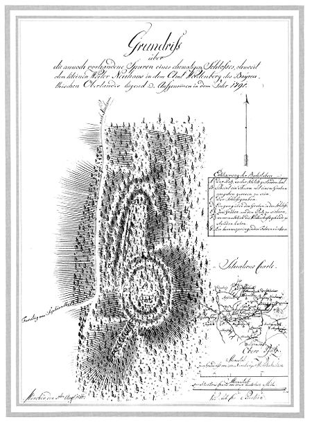
The Burgstall of Schlosshügel near Weidenberg is a lost hill castle or circular rampart site of the type known as a motte from the Early Middle Ages. It lies on the southern perimeter of the Fichtel Mountains at a height of 699 metres above sea level (NN) above the village of Sophienthal, which is part of the market borough of Weidenberg in the Upper Franconia county of Bayreuth in Bavaria. The burgstall or lost castle site was partly investigated by means of an archaeological test excavation and was also mapped several times in the past.
Excerpt from the Wikipedia article Burgstall Schlosshügel (License: CC BY-SA 3.0, Authors, Images).Burgstall Schlosshügel
Neuhausstraße, Weidenberg (VGem)
Geographical coordinates (GPS) Address Website External links Nearby Places Show on map
Geographical coordinates (GPS)
| Latitude | Longitude |
|---|---|
| N 49.95348 ° | E 11.7712 ° |
Address
Burgstall Schlosshügel
Neuhausstraße
95466 Weidenberg (VGem)
Bavaria, Germany
Open on Google Maps


