Thurstaston
Beaches of MerseysideTowns and villages in the Metropolitan Borough of WirralUse British English from August 2020

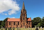
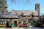
Thurstaston is a village on the Wirral Peninsula, Merseyside, England. It is part of the West Kirby and Thurstaston Ward of the Metropolitan Borough of Wirral and the parliamentary constituency of Wirral West. The village lies on the A540 road between Heswall and Caldy, although it extends some distance down Station Road to the Wirral Way and the River Dee estuary. At the time of the 2001 census, the village itself had only 160 inhabitants, although the national census included Caldy and parts of Irby, bringing the total population to 15,548.
Excerpt from the Wikipedia article Thurstaston (License: CC BY-SA 3.0, Authors, Images).Thurstaston
Church Lane, Wirral
Geographical coordinates (GPS) Address Nearby Places Show on map
Geographical coordinates (GPS)
| Latitude | Longitude |
|---|---|
| N 53.347 ° | E -3.133 ° |
Address
Church Lane
CH61 0HW Wirral
England, United Kingdom
Open on Google Maps


