Thurstaston Common
Local Nature Reserves in MerseysideParks and commons in the Metropolitan Borough of WirralSites of Special Scientific Interest in Merseyside

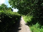
Thurstaston Common is an area of almost 250 acres (100 ha) of parklands, wood and heath between Frankby and Thurstaston, on the Wirral Peninsula in North West England. The common is jointly owned by the National Trust and the Metropolitan Borough of Wirral. Royden Country Park is nearby and offers additional facilities. The Common is a Site of Special Scientific Interest (SSSI) and a local nature reserve. From the top of the 298 ft (91 m) Thurstaston Hill there are views of the Dee Estuary (itself an SSSI) and across to the Clwydian Hills of North Wales. The area is popular with walkers and families.
Excerpt from the Wikipedia article Thurstaston Common (License: CC BY-SA 3.0, Authors, Images).Thurstaston Common
Thurstaston Road, Wirral
Geographical coordinates (GPS) Address Nearby Places Show on map
Geographical coordinates (GPS)
| Latitude | Longitude |
|---|---|
| N 53.355 ° | E -3.135 ° |
Address
NT Thurstaston Common
Thurstaston Road
CH61 0HQ Wirral
England, United Kingdom
Open on Google Maps


