Lemberg (Nahe)
Bad Kreuznach (district)Bad Kreuznach district geography stubsMountains and hills of Rhineland-Palatinate
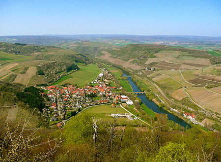
The Lemberg is a hill on the river Nahe between the villages of Niederhausen (Nahe), Oberhausen an der Nahe and Feilbingert. At 422 metres, it is the highest hill on the Nahe. Linguistic researchers believe the derivation of the name Lemberg is Lindberg ("lime hill") and local poets call it the "King of the Nahegau" (König des Nahegaus). The magmatic rock, porphyry, which is found here points to its volcanic origin.
Excerpt from the Wikipedia article Lemberg (Nahe) (License: CC BY-SA 3.0, Authors, Images).Lemberg (Nahe)
K 83, Bad Kreuznach
Geographical coordinates (GPS) Address Website Nearby Places Show on map
Geographical coordinates (GPS)
| Latitude | Longitude |
|---|---|
| N 49.7817 ° | E 7.7679 ° |
Address
NSG Lemberg
K 83
67824 Bad Kreuznach
Rhineland-Palatinate, Germany
Open on Google Maps


