Vltava
Pages including recorded pronunciationsPages with Czech IPAPages with German IPARivers of PragueRivers of the Central Bohemian Region ... and 4 more
Rivers of the South Bohemian RegionTributaries of the ElbeVltavaVltava basin

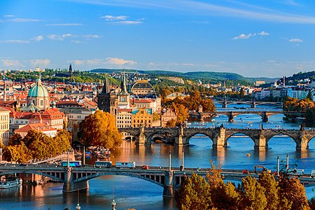
The Vltava ( VU(U)L-tə-və, Czech: [ˈvl̩tava] ; German: Moldau [ˈmɔldaʊ] ) is the longest river in the Czech Republic, running southeast along the Bohemian Forest and then north across Bohemia, through Český Krumlov, České Budějovice and Prague, and finally merging with the Elbe at Mělník. It is commonly referred to as the "Czech national river".
Excerpt from the Wikipedia article Vltava (License: CC BY-SA 3.0, Authors, Images).Vltava
24635, okres Mělník
Geographical coordinates (GPS) Address Nearby Places Show on map
Geographical coordinates (GPS)
| Latitude | Longitude |
|---|---|
| N 50.341388888889 ° | E 14.475 ° |
Address
24635
276 01 okres Mělník, Hořín
Central Bohemia, Czechia
Open on Google Maps


