place

2014 Marysville Pilchuck High School shooting

2014 in Washington (state)2014 mass shootings in the United States2014 murders in the United StatesAttacks in the United States in 2014Crimes in Washington (state)
High school killings in the United StatesHigh school shootings in the United StatesMarysville, WashingtonMass murder in 2014Mass shootings in Washington (state)Mass shootings in the United StatesMurder–suicides in Washington (state)October 2014 crimes in the United StatesOctober 2014 events in the United StatesSchool shootings committed by pupilsSchool shootings in Washington (state)Suicides by firearm in Washington (state)Use American English from March 2019Use mdy dates from October 2014

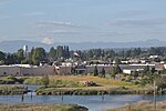
On October 24, 2014, 15-year-old freshman student Jaylen Fryberg shot five students at Marysville Pilchuck High School in Marysville, Washington, fatally wounding four, before shooting and killing himself. Fryberg's father, Raymond Fryberg, was arrested and convicted the following year for illegally purchasing and owning the gun used in the shooting, among other firearm offenses.

Excerpt from the Wikipedia article 2014 Marysville Pilchuck High School shooting (License: CC BY-SA 3.0, Authors).

2014 Marysville Pilchuck High School shooting
55th Avenue Northeast,

Geographical coordinates (GPS) Address Nearby Places
placeShow on map

Wikipedia: 2014 Marysville Pilchuck High School shootingContinue reading on Wikipedia

Geographical coordinates (GPS)

Latitude Longitude
N 48.095994444444 ° E -122.15453888889 °
placeShow on map

Address

Marysville-Pilchuck High School

55th Avenue Northeast
98271
Washington, United States
mapOpen on Google Maps

Share experience

Nearby Places

Marysville, Washington

Marysville is a city in Snohomish County, Washington, United States, part of the Seattle metropolitan area. The city is located 35 miles (56 km) north of Seattle, adjacent to Everett on the north side of the Snohomish River delta. It is the second-largest city in Snohomish County after Everett, with a population of 70,714 at the time of the 2020 U.S. census. As of 2015, Marysville was also the fastest-growing city in Washington state, growing at an annual rate of 2.5 percent. Marysville was established in 1872 as a trading post by James P. Comeford, but was not populated by other settlers until 1883. After the town was platted in 1885, a period of growth brought new buildings and industries to Marysville. In 1891, Marysville was incorporated and welcomed the completed Great Northern Railway. Historically, the area has subsisted on lumber and agrarian products; the growth of strawberry fields in Marysville led to the city being nicknamed the "Strawberry City" in the 1920s. The city experienced its first wave of suburbanization in the 1970s and 1980s, resulting in the development of new housing and commercial areas. Between 1980 and 2000, the population of Marysville increased five-fold. In the early 2000s, annexations of unincorporated areas to the north and east expanded the city to over 20 square miles (52 km2) and brought the population over 60,000. Marysville is oriented north–south along Interstate 5, bordering the Tulalip Indian Reservation to the west, and State Route 9 to the east. Mount Pilchuck, whose 5,300-foot-high (1,600 m) peak can be seen from various points in the city, appears in the city's flag and seal.