place

Tulalip Resort Casino

Buildings and structures in Snohomish County, WashingtonCasino hotelsCasino stubsCasinos completed in 2003Casinos in Washington (state)
Hotel buildings completed in 2008Native American casinosTourist attractions in Snohomish County, WashingtonTulalip TribesWashington (state) building and structure stubs
Tulalip Resort Casino 2023

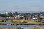
Tulalip Resort Casino is an Indian casino and resort in Quil Ceda Village, Washington, owned and operated by the Tulalip Tribes of Washington. It opened in 2003 as the Tulalip Casino and features 227,000 square feet (21,100 m2) of total space and a parking lot with 5,740 stalls. The resort includes 192,000 square feet (17,800 m2) of gaming space, seven restaurants, a spa, and meeting rooms. The outdoor Tulalip Amphitheatre is used for entertainment events.Construction on the casino began in July 2001 and cost $78 million. The casino opened in June 2003. It replaced an earlier casino that opened in July 1992 and was later renamed to Quil Ceda Creek Casino after a renovation in 2004. A 12-story hotel with 370 rooms was opened on August 15, 2008, shortly after the casino was renamed to the Tulalip Resort Casino; it one of the tallest buildings in Snohomish County. The hotel was renovated in 2015 and was awarded AAA Three Diamond status. The resort is planned to be expanded between 2023 and 2025.

Excerpt from the Wikipedia article Tulalip Resort Casino (License: CC BY-SA 3.0, Authors, Images).

Tulalip Resort Casino
Quil Ceda Boulevard,

Geographical coordinates (GPS) Address Phone number Website Nearby Places
placeShow on map

Wikipedia: Tulalip Resort CasinoContinue reading on Wikipedia

Geographical coordinates (GPS)

Latitude Longitude
N 48.088055555556 ° E -122.18888888889 °
placeShow on map

Address

Tulalip Resort Casino

Quil Ceda Boulevard 10200
98271
Washington, United States
mapOpen on Google Maps

Phone number

call+13607166000

Website
tulalipresortcasino.com

linkVisit website

Tulalip Resort Casino 2023
Share experience

Nearby Places

Marysville, Washington

Marysville is a city in Snohomish County, Washington, United States, part of the Seattle metropolitan area. The city is located 35 miles (56 km) north of Seattle, adjacent to Everett on the north side of the Snohomish River delta. It is the second-largest city in Snohomish County after Everett, with a population of 70,714 at the time of the 2020 U.S. census. As of 2015, Marysville was also the fastest-growing city in Washington state, growing at an annual rate of 2.5 percent. Marysville was established in 1872 as a trading post by James P. Comeford, but was not populated by other settlers until 1883. After the town was platted in 1885, a period of growth brought new buildings and industries to Marysville. In 1891, Marysville was incorporated and welcomed the completed Great Northern Railway. Historically, the area has subsisted on lumber and agrarian products; the growth of strawberry fields in Marysville led to the city being nicknamed the "Strawberry City" in the 1920s. The city experienced its first wave of suburbanization in the 1970s and 1980s, resulting in the development of new housing and commercial areas. Between 1980 and 2000, the population of Marysville increased five-fold. In the early 2000s, annexations of unincorporated areas to the north and east expanded the city to over 20 square miles (52 km2) and brought the population over 60,000. Marysville is oriented north–south along Interstate 5, bordering the Tulalip Indian Reservation to the west, and State Route 9 to the east. Mount Pilchuck, whose 5,300-foot-high (1,600 m) peak can be seen from various points in the city, appears in the city's flag and seal.