Adelgade
Streets in Copenhagen

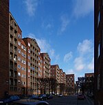
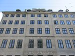
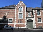
Adelgade (lit. "Nobility Street") is a street in central Copenhagen, Denmark. It runs from Gothersgade in the south to Sankt Pauls Plads with St. Paul's Church in the north. The first half of the street is dominated by modern buildings while its last section passes through the Nyboder district.
Excerpt from the Wikipedia article Adelgade (License: CC BY-SA 3.0, Authors, Images).Adelgade
Adelgade, Copenhagen Christianshavn
Geographical coordinates (GPS) Address Nearby Places Show on map
Geographical coordinates (GPS)
| Latitude | Longitude |
|---|---|
| N 55.6852 ° | E 12.5847 ° |
Address
Adelgade 48
1304 Copenhagen, Christianshavn
Capital Region of Denmark, Denmark
Open on Google Maps


