Lysterfield Park

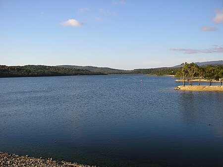
The Lysterfield Park is a public park located in the Greater Melbourne region of Victoria, Australia. The 1,398-hectare (3,450-acre) park is situated approximately 30 kilometres (19 mi) southeast of the Melbourne central business district, adjacent to the suburb of Lysterfield in the City of Casey. When combined with the adjacent Churchill National Park, the two parks comprise 1,668 hectares (4,120 acres) in the Dandenong Valley and the Dandenong Ranges that are a haven for native birds, mammals and reptiles, and provide recreational opportunities.Lysterfield Park was created following the decommissioning of the Lysterfield Reservoir (built in 1936) and placement of its catchment under the management of the then National Park Service in 1979. Gazetted on 19 May 1981 with 1,151 hectares (2,840 acres), extensions to the park were made in 1984, 1988, 1995 and 1997.
Excerpt from the Wikipedia article Lysterfield Park (License: CC BY-SA 3.0, Authors, Images).Lysterfield Park
Powells Track, Melbourne Lysterfield
Geographical coordinates (GPS) Address Nearby Places Show on map
Geographical coordinates (GPS)
| Latitude | Longitude |
|---|---|
| N -37.948888888889 ° | E 145.29611111111 ° |
Address
Powells Track
Powells Track
3158 Melbourne, Lysterfield
Victoria, Australia
Open on Google Maps


