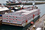
Inner Pierhead Fort
Coastal artilleryForts in DorsetIsle of PortlandJurassic Coast

Inner Pierhead Fort is a 19th-century fort built to defend Portland Harbour at the Isle of Portland, Dorset, England. It is positioned on the end of the inner breakwater, which abuts from the former dockyard of HMNB Portland. The fort was constructed between 1859-1862, and is 100 ft in diameter. The inner breakwater, including the fort, became Grade II Listed in 1978.
Excerpt from the Wikipedia article Inner Pierhead Fort (License: CC BY-SA 3.0, Authors, Images).Inner Pierhead Fort
Inner Breakwater Road,
Geographical coordinates (GPS) Address Nearby Places Show on map
Geographical coordinates (GPS)
| Latitude | Longitude |
|---|---|
| N 50.5691 ° | E -2.4223 ° |
Address
Inner Breakwater
Inner Breakwater Road
DT5 1PA , Portland
England, United Kingdom
Open on Google Maps


