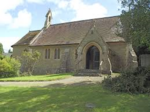
Walford, Letton and Newton
Walford, Letton and Newton is a civil parish in north Herefordshire, England, and approximately 20 miles (30 km) north-northwest from the city and county town of Hereford, and 2 miles (3 km) east from the border with Wales. Parish settlements are the village of Walford, at the north, and the hamlets of Letton and Newton farther south. The post town is Craven Arms and post district, SY7. Parish population at the 2011 census was 179.Walford village is 600 yards (500 m) south of the River Teme, and about 1 mile (1.6 km) south-west of Leintwardine. The A4113 Bromfield to Knighton road runs through the village. Mound remains of a motte-and-bailey are at the east of Walford (grid reference SO3913972413). Letton, 1.5 miles (2 km) south of Walford, comprises two farms and two residential properties. Newton comprises a group of farm buildings and a row of six cottages. At the time of the Domesday Survey Walford was known as 'Waliforde', which may mean 'ford of the Welshmen'.
Excerpt from the Wikipedia article Walford, Letton and Newton (License: CC BY-SA 3.0, Authors).Walford, Letton and Newton
Ludlow Road,
Geographical coordinates (GPS) Address Nearby Places Show on map
Geographical coordinates (GPS)
| Latitude | Longitude |
|---|---|
| N 52.34714 ° | E -2.89984 ° |
Address
Ludlow Road
Ludlow Road
SY7 0JT
England, United Kingdom
Open on Google Maps


