Zirler Berg
KarwendelMountains of Tyrol (state)Mountains of the AlpsOne-thousanders of Austria

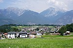
The Zirler Berg near Zirl in the Austrian federal state of Tyrol is a mountain, 1,057 m (AA) high, in the Karwendel Alps, a western part of the Northern Limestone Alps. It is a southern foothill of the Reither Spitze (2,374 m) and is known mainly because the Seefelder Straße (B 177) on its southern slopes climbs through 388 metres in a distance of less than 4 kilometres from Zirl in the Inn valley to Leithen on the Seefeld Plateau.
Excerpt from the Wikipedia article Zirler Berg (License: CC BY-SA 3.0, Authors, Images).Zirler Berg
Zirler Rundwanderweg,
Geographical coordinates (GPS) Address Website Nearby Places Show on map
Geographical coordinates (GPS)
| Latitude | Longitude |
|---|---|
| N 47.28528 ° | E 11.22472 ° |
Address
Bogenschützenplatz Leithen - Waldparcour
Zirler Rundwanderweg
6170
Austria
Open on Google Maps


