Mühringen
Karlsruhe region geography stubsTowns in Baden-Württemberg
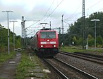
Mühringen is a district of Horb am Neckar. The village is located approximately 8 kilometres (5.0 mi) from the main town and stretches from the valley of the Eyach at an altitude of 401 metres (1,316 ft) above sea level up to the hill of Castle Hohenmühringen. Mühringen has about 1,000 inhabitants. There is a railway station of the Hohenzollerische Landesbahn in the valley; Mühringen is a station of a German Camino de Santiago.
Excerpt from the Wikipedia article Mühringen (License: CC BY-SA 3.0, Authors).Mühringen
Graf-Gerold-Straße, Verwaltungsgemeinschaft Horb am Neckar
Geographical coordinates (GPS) Address Nearby Places Show on map
Geographical coordinates (GPS)
| Latitude | Longitude |
|---|---|
| N 48.4188 ° | E 8.7558 ° |
Address
Graf-Gerold-Straße 8
72160 Verwaltungsgemeinschaft Horb am Neckar, Mühringen
Baden-Württemberg, Germany
Open on Google Maps


