place

Hafelekarspitze

AC with 0 elementsInnsbruckKarwendelMountains of Tyrol (state)Mountains of the Alps
Two-thousanders of Austria
Hafelekar vm02
Hafelekar vm02

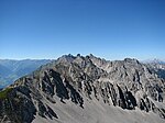
The Hafelekarspitze is a mountain in the so-called North Chain (Nordkette) north of Innsbruck in Austria.

Excerpt from the Wikipedia article Hafelekarspitze (License: CC BY-SA 3.0, Authors, Images).

Hafelekarspitze
Hermann-Buhl-Weg (Goetheweg), Innsbruck Arzl (Mühlau)

Geographical coordinates (GPS) Address Nearby Places
placeShow on map

Wikipedia: HafelekarspitzeContinue reading on Wikipedia

Geographical coordinates (GPS)

Latitude Longitude
N 47.312828 ° E 11.38632 °
placeShow on map

Address

Hermann-Buhl-Weg (Goetheweg)

Hermann-Buhl-Weg (Goetheweg)
6020 Innsbruck, Arzl (Mühlau)
Tyrol, Austria
mapOpen on Google Maps

Hafelekar vm02
Hafelekar vm02
Share experience

Nearby Places

Frau Hitt
Frau Hitt

The Frau Hitt (2,270 m (AA)) is a peak in the Nordkette, the southernmost mountain chain of the Karwendel in Austria. In appearance it resembles a woman (German: Frau) on a horse, hence the name. According to legend the peak is a petrified giant queen, called Frau Hitt, who was known for her avarice and self-infatuation. The legend has various versions. One widespread story is that Frau Hitt only offered a beggar woman a stone to eat. The beggar woman was so incensed by this mockery that she cursed the giantess and her horse, which were then turned into stone as an eternal punishment. In an other version it's the punishment for wasting "soft bread" to clean her spoiled son. Children are told they would end like Frau Hitt if they waste precious food.The prominent rock needle, high above Innsbruck, used to be a tourist symbol for the city. A plan to create a spectacular wrapping over Frau Hitt by artists Christo and Jeanne-Claude finally failed through lack of funds.Frau Hitt was probably first climbed in 1580 by Johann Georg Ernstinger. It was conquered several times during the 19th century by unknown mountaineers. Frau Hitt is usually climbed via the west shoulder (at one place III, otherwise II). To reach this shoulder there is a route from the east (grade II) and a rather more difficult one (III+) from the west. The Frau Hitt Saddle (2,235 m above sea level (AA)) lies west of Frau Hitt, where a crossing from the Inn Valley to the Gleirschtal valley is possible (the protected ascent to the Frau Hitt Cirque (Frau Hitt-Kar) is north of and below Frau Hitt). Neighbouring crossings are: in the west the Erl Saddle near the Solsteinhaus, in the east the Hafelekar top station. Frau Hitt Saddle is the crossing point of the following hiking trails and climbing routes: SE descent on the Schmidhubersteig, then either to the Seegrube (1,905 m above sea level (AA), a station on the Nordkette Cable Car) or descent via the Höttinger Alm to Innsbruck Hut tour from the Solsteinhaus via the Gipfelstürmerweg north of the western Nordkette to the Frau Hitt Saddle, from there continuing to the Seegrube and up to the Hafelekarspitze, from the Hafelekarspitze on the Goethe Way to the Pfeis Hut NW descent through the Frau Hitt Cirque, Kleinkristental, Gleirschtal and the western Hinterau valley to Scharnitz SW ascent to the Vordere Brandjochspitze NE start or finish of the Innsbruck Klettersteig

Nordkette
Nordkette

The Nordkette, also variously called the North Chain, Northern Range, rarely the Inn Valley Range or Inn Valley Chain (Inntalkette), is a range of mountains just north of the city of Innsbruck in Austria. It is the southernmost of the four great mountain chains in the Karwendel. To the west it is linked by the Erl Saddle to the Erlspitze Group, to the east via the Stempeljoch saddle (2,215 m (AA)) to the Gleirsch-Halltal Range. To the south it is bounded by the Inn valley. Its highest summit is the Kleiner Solstein (2,637 m (AA)) in the west of the range. The Nordkette is served by the Nordkette Cable Car, which offers easy access to the ski area and the Innsbruck Klettersteig. The latter starts in the east, near Hafelekar station (2,269 m (AA)) on the Nordkette Cable Car, and runs via the Seegrubenspitze, the Kemacher and the Langen Sattel to Frau Hitt and the Frau Hitt Saddle in the west. In addition, the Goethe Way (Goetheweg) runs from Hafelekar Station along the arête eastwards to the Pfeis Hut north of the Rumer Spitze. Below the Hungerburg - Seegrube section of the Nordkette Cableway runs the Nordkette Singletrail, one of the most challenging routes in Europe for freeride mountain bikers. The following Alpine Club huts in the area of the Nordkette offer climbers bases for multi-day tours taking in numerous summits: the Solsteinhaus, the Neue Magdeburger Hut, the Pfeis Hut and the Bettelwurf Hut (in the Gleirsch-Halltal Range). In the southwest, there is a small massif in front of the Nordkette, the Hechenberg, which reaches a height of 1,943 m (AA) at the Kirchbergköpfl and which is separated from the Nordkette to the northeast and east by the Kranebitter Klamm.

Hofgarten, Innsbruck

The Hofgarten (English: Court Garden) is a protected park located on the edge of the Altstadt (Old Town) section of Innsbruck, Austria. The park covers an area of 10 hectares (25 acres), and borders on the Hofburg, the Kongresshaus, and the Tyrolean State Theatre. The Hofgarten was originally laid out on the site of a river meadow under the direction of Archduke Ferdinand II in the sixteenth century. At the time, it was one of the most elaborate gardens laid out north of the Alps. During its 600-year history, it was turned into a Renaissance garden, a French formal garden and, since 1858, an English landscape garden. Its last conversion was conceived by Friedrich Ludwig von Sckell, but carried out four decades later by an unknown landscape designer who deviated significantly from Sckell's original proposal. The Hofgarten is managed by the Austrian Federal Gardens (Österreichischen Bundesgärten), a subordinate department of the Ministry of the Environment (Bundesministerium für Land- und Forstwirtschaft, Umwelt und Wasserwirtschaft). The Hofgarten is a recreation area within the Old Town with an interesting and varied stock of mature trees, a set of ponds, a modern children's playpark, a palm house, and a popular garden restaurant. The Hofgarten management is responsible for taking care of the park. It is notable that there are still plants in the park that were planted personally by the Austrian Empress, Maria Theresa. The Tiroler Kunstpavillon (Tyrolean Art Pavilion) in the middle of the park dates back to 1733. Today, the pavilion supports numerous events—mainly concerts. Chess tournaments are fought on the outsize chess boards next to the pavilion. There is a lawn for sunbathing in the Hofgarten with a children's playpark. Otherwise walking on the ornate lawns is not permitted because they are susceptible to excessive use. The palm house contains a comprehensive collection of about 1,700 species of plant, which may be viewed mostly on working days. During the temporary art and sculpture exhibitions in the summer season the palm house may also be visited at weekends.