place

Nordkette

AC with 0 elementsInnsbruckKarwendelMountain ranges of Tyrol (state)Mountain ranges of the Alps
Two-thousanders of Austria
Mandlspitze
Mandlspitze

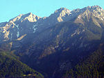
The Nordkette, also variously called the North Chain, Northern Range, rarely the Inn Valley Range or Inn Valley Chain (Inntalkette), is a range of mountains just north of the city of Innsbruck in Austria. It is the southernmost of the four great mountain chains in the Karwendel. To the west it is linked by the Erl Saddle to the Erlspitze Group, to the east via the Stempeljoch saddle (2,215 m (AA)) to the Gleirsch-Halltal Range. To the south it is bounded by the Inn valley. Its highest summit is the Kleiner Solstein (2,637 m (AA)) in the west of the range. The Nordkette is served by the Nordkette Cable Car, which offers easy access to the ski area and the Innsbruck Klettersteig. The latter starts in the east, near Hafelekar station (2,269 m (AA)) on the Nordkette Cable Car, and runs via the Seegrubenspitze, the Kemacher and the Langen Sattel to Frau Hitt and the Frau Hitt Saddle in the west. In addition, the Goethe Way (Goetheweg) runs from Hafelekar Station along the arête eastwards to the Pfeis Hut north of the Rumer Spitze. Below the Hungerburg - Seegrube section of the Nordkette Cableway runs the Nordkette Singletrail, one of the most challenging routes in Europe for freeride mountain bikers. The following Alpine Club huts in the area of the Nordkette offer climbers bases for multi-day tours taking in numerous summits: the Solsteinhaus, the Neue Magdeburger Hut, the Pfeis Hut and the Bettelwurf Hut (in the Gleirsch-Halltal Range). In the southwest, there is a small massif in front of the Nordkette, the Hechenberg, which reaches a height of 1,943 m (AA) at the Kirchbergköpfl and which is separated from the Nordkette to the northeast and east by the Kranebitter Klamm.

Excerpt from the Wikipedia article Nordkette (License: CC BY-SA 3.0, Authors, Images).

Nordkette
Brandjochsteig, Innsbruck

Geographical coordinates (GPS) Address Nearby Places
placeShow on map

Wikipedia: NordketteContinue reading on Wikipedia

Geographical coordinates (GPS)

Latitude Longitude
N 47.3 ° E 11.35 °
placeShow on map

Address

Brandjochsteig

Brandjochsteig
6020 Innsbruck (Hötting)
Tyrol, Austria
mapOpen on Google Maps

Mandlspitze
Mandlspitze
Share experience

Nearby Places

Frau Hitt
Frau Hitt

The Frau Hitt (2,270 m (AA)) is a peak in the Nordkette, the southernmost mountain chain of the Karwendel in Austria. In appearance it resembles a woman (German: Frau) on a horse, hence the name. According to legend the peak is a petrified giant queen, called Frau Hitt, who was known for her avarice and self-infatuation. The legend has various versions. One widespread story is that Frau Hitt only offered a beggar woman a stone to eat. The beggar woman was so incensed by this mockery that she cursed the giantess and her horse, which were then turned into stone as an eternal punishment. In an other version it's the punishment for wasting "soft bread" to clean her spoiled son. Children are told they would end like Frau Hitt if they waste precious food.The prominent rock needle, high above Innsbruck, used to be a tourist symbol for the city. A plan to create a spectacular wrapping over Frau Hitt by artists Christo and Jeanne-Claude finally failed through lack of funds.Frau Hitt was probably first climbed in 1580 by Johann Georg Ernstinger. It was conquered several times during the 19th century by unknown mountaineers. Frau Hitt is usually climbed via the west shoulder (at one place III, otherwise II). To reach this shoulder there is a route from the east (grade II) and a rather more difficult one (III+) from the west. The Frau Hitt Saddle (2,235 m above sea level (AA)) lies west of Frau Hitt, where a crossing from the Inn Valley to the Gleirschtal valley is possible (the protected ascent to the Frau Hitt Cirque (Frau Hitt-Kar) is north of and below Frau Hitt). Neighbouring crossings are: in the west the Erl Saddle near the Solsteinhaus, in the east the Hafelekar top station. Frau Hitt Saddle is the crossing point of the following hiking trails and climbing routes: SE descent on the Schmidhubersteig, then either to the Seegrube (1,905 m above sea level (AA), a station on the Nordkette Cable Car) or descent via the Höttinger Alm to Innsbruck Hut tour from the Solsteinhaus via the Gipfelstürmerweg north of the western Nordkette to the Frau Hitt Saddle, from there continuing to the Seegrube and up to the Hafelekarspitze, from the Hafelekarspitze on the Goethe Way to the Pfeis Hut NW descent through the Frau Hitt Cirque, Kleinkristental, Gleirschtal and the western Hinterau valley to Scharnitz SW ascent to the Vordere Brandjochspitze NE start or finish of the Innsbruck Klettersteig

Botanical Garden of the University of Innsbruck

The Botanical Garden of the University of Innsbruck (German: Botanischer Garten der Universität Innsbruck) is a 2-hectare botanical garden operated by the University of Innsbruck. It is located in Hötting at Sternwartestraße 15, Innsbruck, Austria. The gardens are open at no cost every day; its greenhouses are open on Thursday afternoons for an admission fee. The garden was established around 1911, replacing an earlier garden elsewhere. It was redesigned between 1948 and 1965, and its alpine rock garden was revised 1987–1990 on modern systemic principles. Its first greenhouse was constructed in 1909, with three additional greenhouses added 1977–1979, a succulent house in 1993, and a sixth greenhouse for container plants built in 1997. Today the garden contains more than 5000 species organized within the following major sections: Alpinum (more than 2000 m2) - a major alpine garden, divided geographically and geologically, containing more than 1000 plants from all, non tropical, alpine regions of the world. Includes an area for ferns, a moor, and four ponds. Arboretum - woody plants including Gymnosperms, Angiosperms, and perennial plants. Cactus houses (330 m2) - about 500 cactus species. Cactus-Succulent-Mediterranean House (280 m2) - primarily plants from the Mediterranean, the Canary Islands, the colder regions of Australia and New Zealand, as well as African succulent plants and American cacti. Fern house (70 m2) - epiphytes, climbing ferns, and water ferns. Fragrance and touch garden (built 1999) - the first in Austria, all plants labeled in Braille. Medicinal, poisonous, and spice plants - more than 300 plants ordered by their effective substances (alkaloids, glycocholic acid, tannins, ethereal oils, vitamins, etc. Orchid house Succulent house - over 550 succulent plants, mainly from South Africa, the Canary Islands, and South America. Systematic garden (1000 m2, rebuilt 1993) Tropical greenhouse (287 m2, height above 12 m2) - flowering and useful tropical plants.