place

Peninsula Barracks, Warrington

Barracks in EnglandInstallations of the British Army
Peninsula Barracks, Warrington

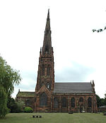
Peninsula Barracks is a military installation on O'Leary Street in Warrington, England.

Excerpt from the Wikipedia article Peninsula Barracks, Warrington (License: CC BY-SA 3.0, Authors, Images).

Peninsula Barracks, Warrington
O'Leary Street,

Geographical coordinates (GPS) Address Nearby Places
placeShow on map

Wikipedia: Peninsula Barracks, WarringtonContinue reading on Wikipedia

Geographical coordinates (GPS)

Latitude Longitude
N 53.40032 ° E -2.58171 °
placeShow on map

Address

O'Leary Street 2
WA2 7RQ , Padgate
England, United Kingdom
mapOpen on Google Maps

Peninsula Barracks, Warrington
Share experience

Nearby Places

Orford Park

Orford Park is a municipal park in the town of Warrington, Cheshire, England. Orford Hall and surrounding lands were donated to Warrington Council in December 1916. The hall was demolished in 1935 but its grounds remain as Orford Park, a green lung in an area near the town centre. There are plans for major sport and community development in the park, which is currently the site of two tennis courts and a bowling green. In 2009, a £30m redevelopment project for the park was approved by Warrington Borough Council. Work began in May of that year and concluded three years later in May 2012. The project saw Orford Jubilee Neighbourhood Hub built on the western end of Orford Park, which was opened by Elizabeth II as part of her Diamond Jubilee celebrations. A Decathlon sports store was built on the land directly adjacent to Winwick Road. New paved paths were installed to create a route for pedestrians and cycles between Winwick Road, Hallfields Road and School Road. A pond was added at the northern edge of the park. The original main area in the southeast of the park was updated; it now boasts a skate park, children's playground, bowling green, ball court and football pitches. The park is home to number of British birds, mammals, amphibians, fish and invertebrates, along with occasional visiting reptiles. Some common species include mallards, black-headed gulls, water voles, common frogs and common gulls. William Beamont, a local historian and the first Mayor of Warrington lived in Orford Hall for some 23 years, until his death in 1889.

Warrington
Warrington

Warrington () is an industrial town in the borough of the same name in Cheshire, England. The town sits on the banks of the River Mersey and until 1974, was part of Lancashire. It is 19 miles (31 km) east of Liverpool, and 18 miles (29 km) west of Manchester. The population in 2019 was estimated at 165,456 for the town's urban area, and 210,014 for the wider borough, the latter being more than double that of 1968 when it became a new town. Warrington is the largest town in the ceremonial county of Cheshire. Warrington was founded by the Romans at an important crossing place on the River Mersey. A new settlement was established by the Saxon Wærings. By the Middle Ages, Warrington had emerged as a market town at the lowest bridging point of the river. A local tradition of textile and tool production dates from this time.The expansion and urbanisation of Warrington coincided with the Industrial Revolution, particularly after the Mersey was made navigable in the 18th century. The West Coast Main Line runs north to south through the town, and the Liverpool to Manchester railway (the Cheshire Lines route) west to east. The Manchester Ship Canal cuts through the south of the borough (west to east). The M6, M56 and M62 motorways form a partial box around the town and are all accessible through Warrington. The modern Borough of Warrington was formed in 1974 with the amalgamation of the former County Borough of Warrington, part of the Golborne Urban District, the Lymm Urban District, part of the Runcorn Rural District, the Warrington Rural District and part of the Whiston Rural District.