place

Warrior Run High School

Education in Montour County, PennsylvaniaEducation in Northumberland County, PennsylvaniaEducation in Union County, PennsylvaniaPublic high schools in PennsylvaniaSusquehanna Valley
Map of Northumberland County Pennsylvania School Districts

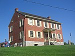
Warrior Run High School is a small, rural public high school located in Turbotville, Pennsylvania. It is the sole high school operated by the Warrior Run School District. It serves the residents of the boroughs of Turbotville, McEwensville and Watsontown. It also serves Gregg Township in Union County, Delaware Township and Lewis Township in Northumberland County; as well as Anthony Township and Limestone Township in Montour County. In 2016, Warrior Run High School reported its enrollment was 479 pupils. Warrior Run High School students may choose to attend Lycoming Career and Technology Center [1] for training in the building trades, automotive technology, culinary arts, allied health services and child care. The Central Susquehanna Intermediate Unit CSIU16 provides the high school with a wide variety of services like specialized education for disabled students and hearing, speech and visual disability services and professional development for staff and faculty.

Excerpt from the Wikipedia article Warrior Run High School (License: CC BY-SA 3.0, Authors, Images).

Warrior Run High School
Susquhanna Trail, Lewis Township

Geographical coordinates (GPS) Address External links Nearby Places
placeShow on map

Wikipedia: Warrior Run High SchoolContinue reading on Wikipedia

Geographical coordinates (GPS)

Latitude Longitude
N 41.1035 ° E -76.803 °
placeShow on map

Address

Warrior Run High School

Susquhanna Trail
17749 Lewis Township
Pennsylvania, United States
mapOpen on Google Maps

linkWikiData (Q18157406)
linkOpenStreetMap (357319079)

Map of Northumberland County Pennsylvania School Districts
Share experience

Nearby Places

White Deer Creek
White Deer Creek

White Deer Creek is a tributary of the West Branch Susquehanna River in Centre County and Union County, in Pennsylvania, in the United States. It is approximately 28 miles (45 km) long and flows through Miles Township in Centre County and Hartley Township, Lewis Township, West Buffalo Township, and White Deer Township in Union County. The watershed of the creek has an area of 45.1 square miles (117 km2). Parts of the creek are designated as impaired. The creek's discharge near White Deer can be as low as 3 cubic feet per second (0.085 m3/s) or as high as 169 cubic feet per second (4.8 m3/s). White Deer Creek is a freestone stream in mountainous terrain. It is relatively small and flows through a valley that is narrow, but can be up to 1,000 feet (300 m) wide. The creek flows alongside Interstate 80 for much of its length. A significant part of the land in the creek's watershed is forested, with large areas being owned by the Pennsylvania Bureau of Forestry. The watershed of the creek is designated as a High-Quality Coldwater Fishery and a Migratory Fishery. It has both brook trout and brown trout and is stocked with trout. White Deer Creek's name comes from the word Woap'-achtu-hanne, meaning "white-deer stream". The creek appeared on maps as early as 1759. A number of mills were erected adjacent to it during the eighteenth and nineteenth centuries. Major historic industries in the watershed included lumbering and agriculture. A number of bridges have been erected across the creek. Much of the length of White Deer Creek is in Bald Eagle State Forest; the creek also passes through McCalls Dam State Park. Other recreational opportunities include angling and canoeing.