place

Murrin Provincial Park

1962 establishments in British ColumbiaBritish Columbia protected area stubsIUCN Category IIProtected areas established in 1962Provincial parks of British Columbia
Sea-to-Sky CorridorSquamish people
Murrin PP
Murrin PP

Murrin Provincial Park is a provincial park in British Columbia, Canada, located just south of Squamish beside the Sea-to-Sky Highway. The park is approximately 24 ha. in size and has a popular highway-side picnic ground and small swimming lake (Browning Lake), but it is most notable for a collection of petroglyphs located away from the highway and accessed by trail. Several rockfaces in the area of the park are popular with the local mountain-climbing community, though the site is nowhere as busy as the nearby Stawamus Chief. Other provincial parks nearby are Stawamus Chief Provincial Park, Shannon Falls Provincial Park and Porteau Cove Provincial Park.

Excerpt from the Wikipedia article Murrin Provincial Park (License: CC BY-SA 3.0, Authors, Images).

Murrin Provincial Park
Sea-to-Sky Highway, Squamish

Geographical coordinates (GPS) Address Website External links Nearby Places
placeShow on map

Wikipedia: Murrin Provincial ParkContinue reading on Wikipedia

Geographical coordinates (GPS)

Latitude Longitude
N 49.644444444444 ° E -123.20833333333 °
placeShow on map

Address

Murrin Provincial Park

Sea-to-Sky Highway
V0N 1J0 Squamish
British Columbia, Canada
mapOpen on Google Maps

Website
bcparks.ca

linkVisit website

linkWikiData (Q6939596)
linkOpenStreetMap (8634836)

Murrin PP
Murrin PP
Share experience

Nearby Places

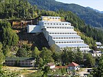
Britannia Mines Concentrator

The Britannia Mines Concentrator is a National Historic Site of Canada. The large, inclined gravity mill was built on the northwest side of Mount Sheer to assist the transfer of copper ore through the chemical and mechanical processes of the plant. It is a landmark in Britannia Beach, British Columbia some forty-five kilometers north of Vancouver. The nearby volcanic peak of Mount Garibaldi indicates the presence of magmatic inclusions and volcanic cores, in which copper is usually found. As such, the town and mill sit on the western shore of the Britannia Range and defined by the large fjord of Howe Sound. The mining claims were discovered in the 1880s and the Britannia Beach Mining and Smelting Company established in the Edwardian years. Copper was first mined in the area in 1903 and the distance from smelters necessitated the construction of an ore concentrator, a system to deliver ore, and a system to ship the ore concentrate. A primitive concentrator, No. 1, was built in 1904, which was upgraded with two more units, collective known as No.2, built in 1914 and 1915. A fire in 1921 destroyed these, and a concrete and steel structure to house a new concentrator was completed (immediately to the right of the 1914 plant) in early 1923. In the late 1920s, Britannia Mines was the most productive copper mine in the British Empire, and it also produced silver and gold. Now owned by the Britannia Beach Historical Society, it is part of the Britannia Mine Museum.