Shiremoor

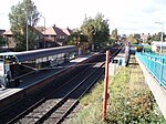
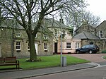
Shiremoor (originally called Tynemouthshire Moor) is a large village in the Metropolitan Borough of North Tyneside. It is located approximately 3+1⁄2 miles (5.5 kilometres) inland of Whitley Bay and approximately three miles (five kilometres) north of The Tyne Tunnel. One mile (1.5 kilometres) or so north of Shiremoor, the extensive built-up areas of North Tyneside change abruptly into green belt stretching north into south east Northumberland. It has a population of 4,782.Shiremoor is not historically a centre of population but many housing estates were built there in the 20th and 21st centuries. Shiremoor was first built as a colliery village to accommodate the miners of the local pits. Shiremoor comprises numerous estates. They include the oldest two estates of Bertram Grange and Old Shiremoor. As well as Park Estate, Leeches Estate, and Shiremoor. In the early 2000s a new area was built, known as Northumberland Park. Although built as a separate village, estate agents refer to it as being a part of Shiremoor. Earsdon View is the newest estate to be built to the north of Shiremoor.
Excerpt from the Wikipedia article Shiremoor (License: CC BY-SA 3.0, Authors, Images).Shiremoor
Park Lane, North Tyneside
Geographical coordinates (GPS) Address Nearby Places Show on map
Geographical coordinates (GPS)
| Latitude | Longitude |
|---|---|
| N 55.03656 ° | E -1.504758 ° |
Address
SHIREMOOR (M)
Park Lane
NE27 0TA North Tyneside
England, United Kingdom
Open on Google Maps


