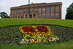
Poulton-le-Sands

Poulton-le-Sands is one of three small villages that combined to create Morecambe, Lancashire, England, the other two being Torrisholme and Bare. A local board of health was established in 1852, which, taking its name from Morecambe Bay, became the borough of Morecambe in 1902.Poulton is known locally for its many murals which depict the origin of Poulton as a fishing village. Artist Patricia Haskey-Knowles completed several of these in the Morecambe Bay area.Poulton was first mentioned in the Domesday Book as Poltune. It later became Poulton and remained this way for a number of centuries. The name 'Poulton' is likely a combination of Old English pull or pōl, meaning 'pool' and tūn meaning 'farmstead'. It was towards the end of the eighteenth or the beginning of the nineteenth century that the Le-Sands was added. This was to distinguish it from another Poulton located near Blackpool which is now Poulton-le-Fylde.
Excerpt from the Wikipedia article Poulton-le-Sands (License: CC BY-SA 3.0, Authors, Images).Poulton-le-Sands
Church Street, Lancaster
Geographical coordinates (GPS) Address Phone number Website Nearby Places Show on map
Geographical coordinates (GPS)
| Latitude | Longitude |
|---|---|
| N 54.074 ° | E -2.858 ° |
Address
Poulton-le-Sands Church of England Primary School
Church Street
LA4 5QA Lancaster
England, United Kingdom
Open on Google Maps


